French Rocks night lights from space
Night Light of French Rocks (Karnataka) from space (India) Src. Average luminocity for 10x10km area is 19.8074% and for 50x50km: 18.895%.
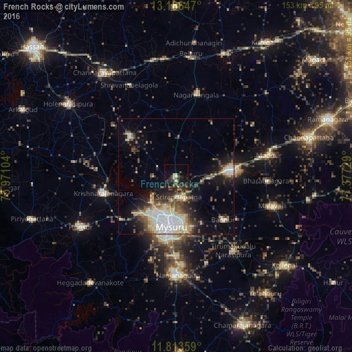
Analysis of French Rocks night lights 2016
Square area 10x10 km:
 0.43%
0.43%90-99
2.81%80-89
2.38%70-79
0.43%60-69
0%50-59
4.11%40-49
6.71%30-39
5.84%20-29
8.87%10-19
21.43%0-9
46.97%Square area 50x50 km:
3.27%90-99
3.29%80-89
3.15%70-79
1.51%60-69
1.53%50-59
2.44%40-49
3.32%30-39
3.42%20-29
4.93%10-19
8.32%0-9
64.83%Clear (daylight) street map image can be seen on geolist.org.
Map coordinates:
13° 11' 11.3" North, 75° 58' 15.7" East
12° 30' 3.4" North, 76° 40' 27" East
11° 48' 48.9" North, 77° 22' 38.2" East
Some cities around French Rocks sort by population:
• Mysore
22.9 km =14.2 mi,  189°
189°
• Mandya
24.4 km =15.2 mi,  84°
84°
• Maddūr
41 km =25.5 mi, 77°
• Bannūr
27.7 km =17.2 mi,  132°
132°
• Krishnarājpet
27.3 km =17 mi,  312°
312°
• Shrīrangapattana
8.8 km =5.5 mi,  172°
172°
• Nāgamangala
36.5 km =22.7 mi,  13°
13°
• Tirumakūdal Narsipur
40.5 km =25.2 mi,  142°
142°
1260553 (p: 19,051)
Sources (retrieved 2019-11-25):
» Earth at Night: Flat Maps 2012, 2016