Mysore night lights from space
Night Light of Mysore (Karnataka) from space (India) Src. Average luminocity for 10x10km area is 95.3967% and for 50x50km: 24.9553%.
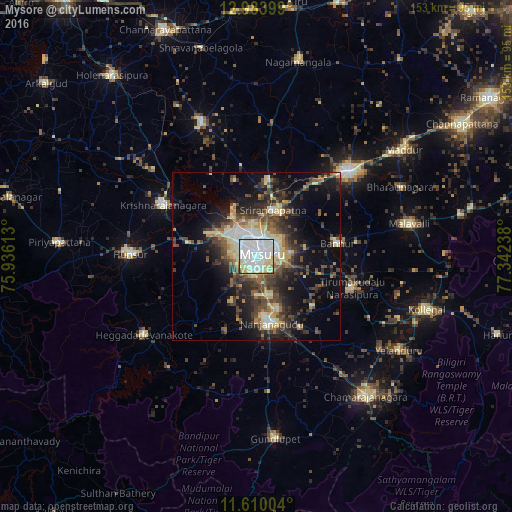
Analysis of Mysore night lights 2016
Square area 10x10 km:
 52.48%
90-99
31.82%80-89
10.74%70-79
2.07%60-69
0.83%50-59
1.65%40-49
0.41%30-39
0%20-29
0%10-19
0%0-9
0%Square area 50x50 km:
3.49%90-99
4.05%80-89
4.05%70-79
2.1%60-69
2.26%50-59
3.43%40-49
5.76%30-39
5.45%20-29
7.42%10-19
11.73%0-9
50.26%Clear (daylight) street map image can be seen on geolist.org.
Map coordinates:
12° 59' 2.4" North, 75° 56' 10.1" East
12° 17' 52.5" North, 76° 38' 21.3" East
11° 36' 36.1" North, 77° 20' 32.6" East
Some cities around Mysore sort by population:
• Mandya
37.5 km =23.3 mi,  48°
48°
• Nanjangūd
20.6 km =12.8 mi,  166°
166°
• Hunsūr
37.6 km =23.4 mi,  270°
270°
• Bannūr
24.5 km =15.2 mi,  80°
80°
• Shrīrangapattana
14.7 km =9.1 mi,  19°
19°
• French Rocks
22.9 km =14.2 mi,  9°
9°
• Heggadadevankote
41 km =25.5 mi,  235°
235°
• Tirumakūdal Narsipur
30.1 km =18.7 mi,  108°
108°
1262321 (p: 868,313)
Sources (retrieved 2019-11-25):
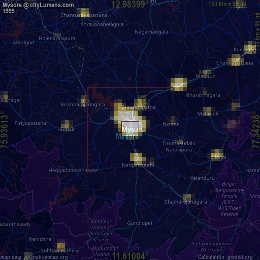
» NASA, Earths city lights 1995
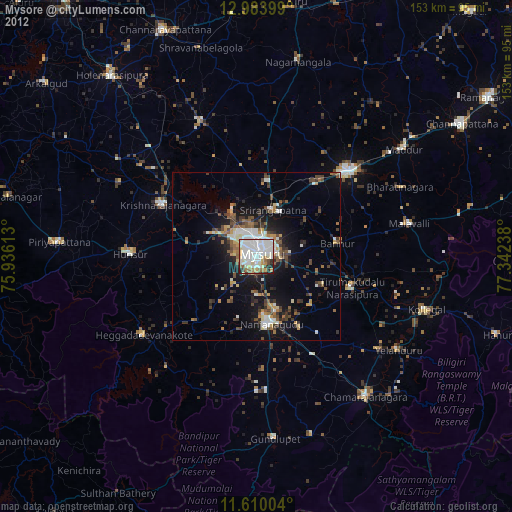
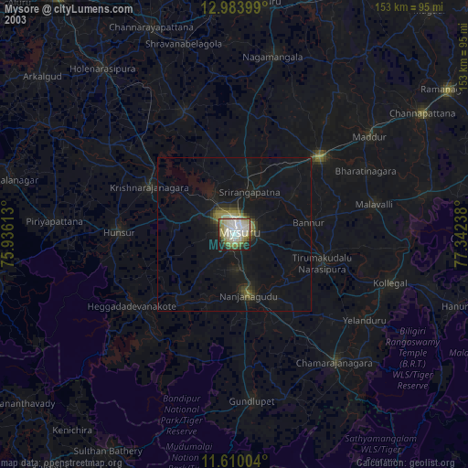
» NASA city lights 2003
» Earth at Night: Flat Maps 2012, 2016