Chikmagalūr night lights from space
Night Light of Chikmagalūr (Karnataka) from space (India) Src. Average luminocity for 10x10km area is 44.8368% and for 50x50km: 3.2109%.
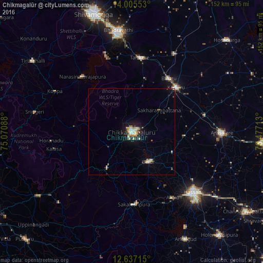
Analysis of Chikmagalūr night lights 2016
Square area 10x10 km:
 4.34%
4.34%90-99
14.26%80-89
8.06%70-79
5.79%60-69
4.55%50-59
2.69%40-49
5.79%30-39
5.37%20-29
5.17%10-19
38.43%0-9
5.58%Square area 50x50 km:
0.22%90-99
0.77%80-89
0.51%70-79
0.24%60-69
0.38%50-59
0.3%40-49
0.31%30-39
0.41%20-29
0.48%10-19
2.82%0-9
93.57%Clear (daylight) street map image can be seen on geolist.org.
Map coordinates:
14° 0' 19.9" North, 75° 4' 15.2" East
13° 19' 20.3" North, 75° 46' 26.4" East
12° 38' 13.7" North, 76° 28' 37.7" East
Some cities around Chikmagalūr sort by population:
• Tarikere
43.3 km =26.9 mi,  5°
5°
• Kadūr
36.3 km =22.6 mi,  45°
45°
• Sakleshpur
42.4 km =26.3 mi,  178°
178°
• Birūr
37.3 km =23.2 mi,  34°
34°
• Belūr
20 km =12.4 mi,  150°
150°
• Mudgere
25.4 km =15.8 mi,  214°
214°
• Bānāvar
43.2 km =26.8 mi,  76°
76°
• Narasimharājapura
42.8 km =26.6 mi,  318°
318°
1274220 (p: 121,484)
Sources (retrieved 2019-11-25):
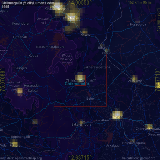
» NASA, Earths city lights 1995
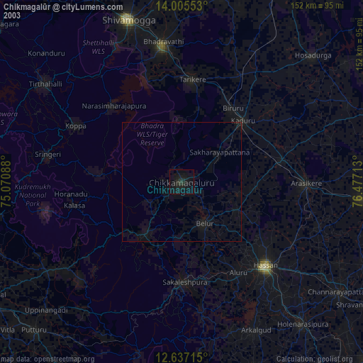
» NASA city lights 2003
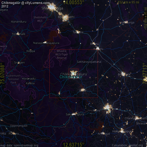
» Earth at Night: Flat Maps 2012, 2016