Bānāvar night lights from space
Night Light of Bānāvar (Karnataka) from space (India) Src. Average luminocity for 10x10km area is 3.2872% and for 50x50km: 3.5667%.
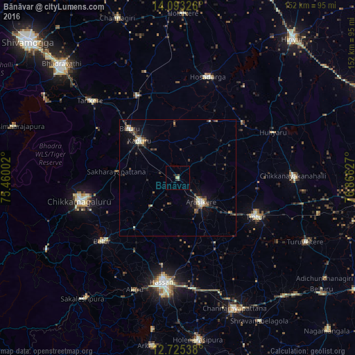
Analysis of Bānāvar night lights 2016
Square area 10x10 km:
 0%
0%90-99
0%80-89
1.24%70-79
0.41%60-69
0%50-59
1.24%40-49
0.41%30-39
0%20-29
2.07%10-19
0.41%0-9
94.21%Square area 50x50 km:
0.26%90-99
0.52%80-89
0.32%70-79
0.28%60-69
0.35%50-59
0.65%40-49
0.65%30-39
0.93%20-29
0.99%10-19
2.31%0-9
92.72%Clear (daylight) street map image can be seen on geolist.org.
Map coordinates:
14° 5' 35.7" North, 75° 27' 36.1" East
13° 24' 37" North, 76° 9' 47.3" East
12° 43' 31.4" North, 76° 51' 58.6" East
Some cities around Bānāvar sort by population:
• Chikmagalūr
43.2 km =26.8 mi,  256°
256°
• Tiptūr
38.1 km =23.7 mi,  116°
116°
• Arsikere
14.7 km =9.1 mi,  136°
136°
• Kadūr
22.8 km =14.2 mi,  314°
314°
• Hosdurga
44.9 km =27.9 mi,  16°
16°
• Birūr
29.3 km =18.2 mi,  315°
315°
• Belūr
42.2 km =26.2 mi,  229°
229°
• Ajjampur
39.2 km =24.4 mi,  334°
334°
1277408 (p: 7,827)
Sources (retrieved 2019-11-25):
» Earth at Night: Flat Maps 2012, 2016