Cheyyur night lights from space
Night Light of Cheyyur (Tamil Nadu) from space (India) Src. Average luminocity for 10x10km area is 3.2996% and for 50x50km: 5.7831%.
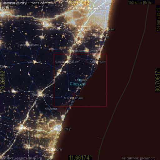
Analysis of Cheyyur night lights 2016
Square area 10x10 km:
 0%
0%90-99
0%80-89
0%70-79
0%60-69
0%50-59
0%40-49
1.65%30-39
3.1%20-29
2.69%10-19
2.07%0-9
90.5%Square area 50x50 km:
0.1%90-99
0.44%80-89
0.83%70-79
0.49%60-69
0.65%50-59
1.06%40-49
1.46%30-39
1.69%20-29
1.69%10-19
5.66%0-9
85.93%Clear (daylight) street map image can be seen on geolist.org.
Map coordinates:
13° 2' 7.5" North, 79° 17' 59.7" East
12° 20' 58.1" North, 80° 0' 10.9" East
11° 39' 42.3" North, 80° 42' 22.2" East
Some cities around Cheyyur sort by population:
• Tindivanam
39.9 km =24.8 mi,  251°
251°
• Chingleput
38.2 km =23.7 mi,  355°
355°
• Madurāntakam
22.1 km =13.7 mi,  324°
324°
• Uttiramerūr
39.7 km =24.7 mi, 317°
• Marakkanam
18.7 km =11.6 mi,  200°
200°
• Seven Pagodas
36.6 km =22.7 mi,  34°
34°
• Karumbākkam
40.3 km =25 mi,  13°
13°
• Singapperumālkovil
45.6 km =28.3 mi,  0°
0°
1274383 (p: 11,060)
Sources (retrieved 2019-11-25):
» Earth at Night: Flat Maps 2012, 2016