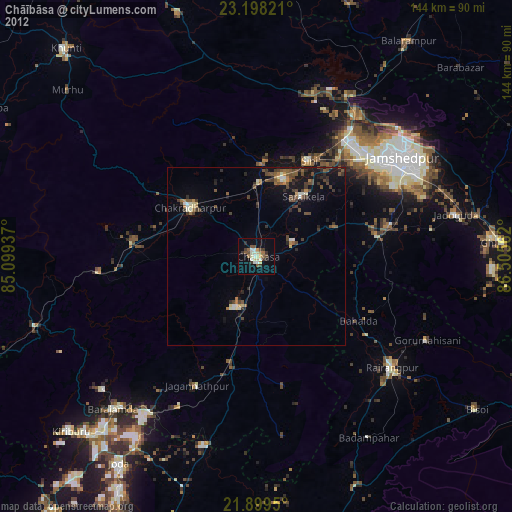
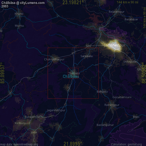
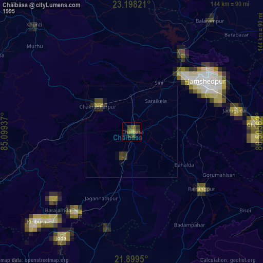
Chāībāsa night lights from space
Night Light of Chāībāsa (Jharkhand) from space (India) Src. Average luminocity for 10x10km area is 42.4754% and for 50x50km: 10.7462%.

Analysis of Chāībāsa night lights 2016
Square area 10x10 km:
 8.52%
8.52%90-99
7.39%80-89
2.08%70-79
5.68%60-69
6.82%50-59
5.49%40-49
4.73%30-39
10.98%20-29
10.8%10-19
31.82%0-9
5.68%Square area 50x50 km:
0.86%90-99
1.12%80-89
0.35%70-79
0.86%60-69
1.29%50-59
1.78%40-49
2.36%30-39
3.28%20-29
5.01%10-19
10.59%0-9
72.47%Clear (daylight) street map image can be seen on geolist.org.
Map coordinates:
23° 11' 53.6" North, 85° 5' 57.7" East
22° 33' 1.4" North, 85° 48' 9" East
21° 53' 58.2" North, 86° 30' 20.2" East
Some cities around Chāībāsa sort by population:
• Chakradharpur
22.6 km =14 mi,  308°
308°
• Gobindpur
29.1 km =18.1 mi,  71°
71°
• Saraikela
21.2 km =13.2 mi,  38°
38°
• Kharsāwān
26.9 km =16.7 mi,  6°
6°
• Jagannāthpur
40.3 km =25 mi,  204°
204°
• Kāndra
42.2 km =26.2 mi, 37°
• Sini
30.7 km =19.1 mi,  28°
28°
• Gopināthpur
30.6 km =19 mi, 65°
1274928 (p: 66,252)
Sources (retrieved 2019-11-25):
» NASA, Earths city lights 1995
» NASA city lights 2003
» Earth at Night: Flat Maps 2012, 2016