Birmitrapur night lights from space
Night Light of Birmitrapur (Odisha) from space (India) Src. Average luminocity for 10x10km area is 14.5379% and for 50x50km: 14.1663%.
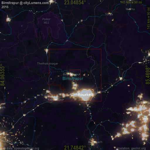
Analysis of Birmitrapur night lights 2016
Square area 10x10 km:
 1.52%
1.52%90-99
3.41%80-89
0.76%70-79
0.19%60-69
1.89%50-59
2.65%40-49
1.7%30-39
1.14%20-29
1.89%10-19
14.02%0-9
70.83%Square area 50x50 km:
3.74%90-99
2.7%80-89
1.05%70-79
0.81%60-69
1.27%50-59
2.17%40-49
2.37%30-39
2.31%20-29
3.34%10-19
7.76%0-9
72.49%Clear (daylight) street map image can be seen on geolist.org.
Map coordinates:
23° 2' 54.7" North, 84° 3' 48.8" East
22° 24' 0" North, 84° 46' 0" East
21° 44' 54.3" North, 85° 28' 11.3" East
Some cities around Birmitrapur sort by population:
• Raurkela
21.9 km =13.6 mi,  152°
152°
• Barbil
71.1 km =44.2 mi,  117°
117°
• Simdega
36.2 km =22.5 mi,  311°
311°
• Manoharpur
43.9 km =27.3 mi,  93°
93°
• Bolānīkhodān
66.7 km =41.4 mi, 118°
• Gua
67.2 km =41.8 mi,  107°
107°
• Bānposh
17.5 km =10.9 mi,  165°
165°
• Kiri Buru
69.6 km =43.2 mi, 120°
1275506 (p: 27,879)
Sources (retrieved 2019-11-25):
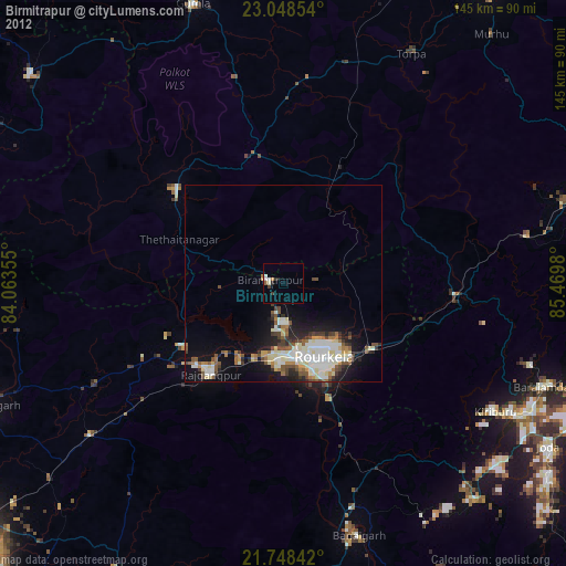
» Earth at Night: Flat Maps 2012, 2016