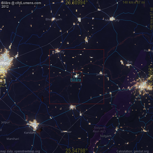
Bilāra night lights from space
Night Light of Bilāra (Rajasthan) from space (India) Src. Average luminocity for 10x10km area is 15.8929% and for 50x50km: 2.9008%.
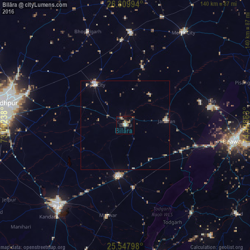
Analysis of Bilāra night lights 2016
Square area 10x10 km:
100  0.99%
0.99%
90-99 2.18%
80-89 1.59%
70-79 2.38%
60-69 2.78%
50-59 2.98%
40-49 2.18%
30-39 4.17%
20-29 1.39%
10-19 3.17%
0-9 76.19%
0.99%90-99
2.18%80-89
1.59%70-79
2.38%60-69
2.78%50-59
2.98%40-49
2.18%30-39
4.17%20-29
1.39%10-19
3.17%0-9
76.19%Square area 50x50 km:
100 0.17%
90-99 0.65%
80-89 0.16%
70-79 0.32%
60-69 0.3%
50-59 0.55%
40-49 0.46%
30-39 0.68%
20-29 0.44%
10-19 0.74%
0-9 95.55%
0.17%90-99
0.65%80-89
0.16%70-79
0.32%60-69
0.3%50-59
0.55%40-49
0.46%30-39
0.68%20-29
0.44%10-19
0.74%0-9
95.55%Clear (daylight) street map image can be seen on geolist.org.
Map coordinates:
26° 48' 35.8" North, 73° 0' 8.6" East
26° 10' 50.4" North, 73° 42' 19.8" East
25° 32' 52.7" North, 74° 24' 31.1" East
Some cities around Bilāra sort by population:
• Pāli
59.3 km =36.8 mi,  220°
220°
• Beāwar
62 km =38.5 mi,  98°
98°
• Merta
61.5 km =38.2 mi,  32°
32°
• Sojat
28.7 km =17.8 mi,  187°
187°
• Pīpār
27.8 km =17.3 mi,  324°
324°
• Jaitāran
23.2 km =14.4 mi,  83°
83°
• Nīmāj
29.7 km =18.5 mi, 96°
• Raipur
35.3 km =21.9 mi,  115°
115°
1275647 (p: 41,710)
Sources (retrieved 2019-11-25):
» Earth at Night: Flat Maps 2012, 2016