Jogbani night lights from space
Night Light of Jogbani (Bihar) from space (India) Src. Average luminocity for 10x10km area is 32.5133% and for 50x50km: 16.8698%.
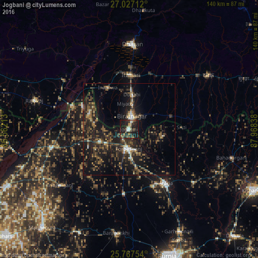
Analysis of Jogbani night lights 2016
Square area 10x10 km:
 2.08%
2.08%90-99
4.17%80-89
4.36%70-79
2.65%60-69
2.84%50-59
5.49%40-49
5.3%30-39
8.71%20-29
16.29%10-19
44.89%0-9
3.22%Square area 50x50 km:
0.75%90-99
1.38%80-89
1%70-79
1.38%60-69
2.25%50-59
3.32%40-49
4.27%30-39
5.29%20-29
8.13%10-19
18.46%0-9
53.76%Clear (daylight) street map image can be seen on geolist.org.
Map coordinates:
27° 1' 37.6" North, 86° 33' 43.7" East
26° 23' 56.6" North, 87° 15' 54.9" East
25° 46' 3.1" North, 87° 58' 6.2" East
Some cities around Jogbani sort by population:
• Biratnagar, NP
6.2 km =3.9 mi,  4°
4°
• Inaruwa, NP
25.9 km =16.1 mi,  333°
333°
• Titahari, NP
29.4 km =18.3 mi, 1°
• Forbesganj
10.7 km =6.6 mi,  179°
179°
• Shahbazpur
10.7 km =6.6 mi,  167°
167°
• Bhawanipur
24.4 km =15.2 mi,  284°
284°
• Chhātāpur
32.7 km =20.3 mi,  232°
232°
• Bīrpur
28 km =17.4 mi,  295°
295°
1268855 (p: 33,300)
Sources (retrieved 2019-11-25):
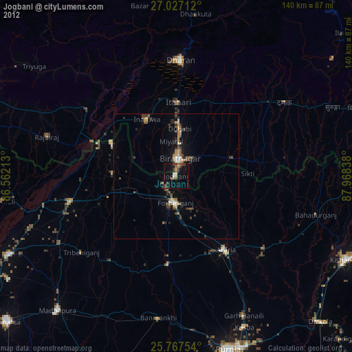
» Earth at Night: Flat Maps 2012, 2016