Barddhamān night lights from space
Night Light of Barddhamān (West Bengal) from space (India) Src. Average luminocity for 10x10km area is 72.4602% and for 50x50km: 17.0892%.
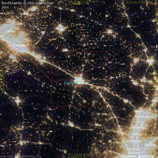
Analysis of Barddhamān night lights 2016
Square area 10x10 km:
 11.36%
90-99
35.42%80-89
7.77%70-79
3.6%60-69
5.87%50-59
7.95%40-49
11.17%30-39
6.25%20-29
10.04%10-19
0.57%0-9
0%Square area 50x50 km:
0.71%90-99
1.95%80-89
1.16%70-79
1.33%60-69
1.84%50-59
3.39%40-49
4.4%30-39
5.05%20-29
7.32%10-19
13.87%0-9
58.98%Clear (daylight) street map image can be seen on geolist.org.
Map coordinates:
23° 54' 0.5" North, 87° 9' 13.6" East
23° 15' 20.6" North, 87° 51' 24.9" East
22° 36' 29.4" North, 88° 33' 36.1" East
Some cities around Barddhamān sort by population:
• Arāmbāgh
42.1 km =26.2 mi,  190°
190°
• Memāri
26.1 km =16.2 mi,  109°
109°
• Guskhara
29.2 km =18.1 mi,  334°
334°
• Tarakeswar
44.1 km =27.4 mi,  158°
158°
• Sonāmukhi
45.6 km =28.3 mi,  276°
276°
• Srirāmpur
38 km =23.6 mi,  154°
154°
• Pātrasāer
33.7 km =20.9 mi,  258°
258°
• Bāgnān
46 km =28.6 mi,  141°
141°
1277029 (p: 301,725)
Sources (retrieved 2019-11-25):
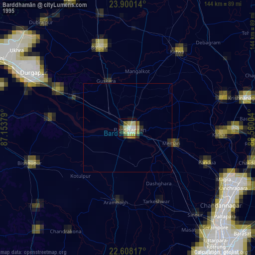
» NASA, Earths city lights 1995
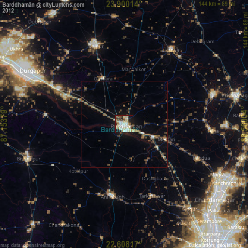
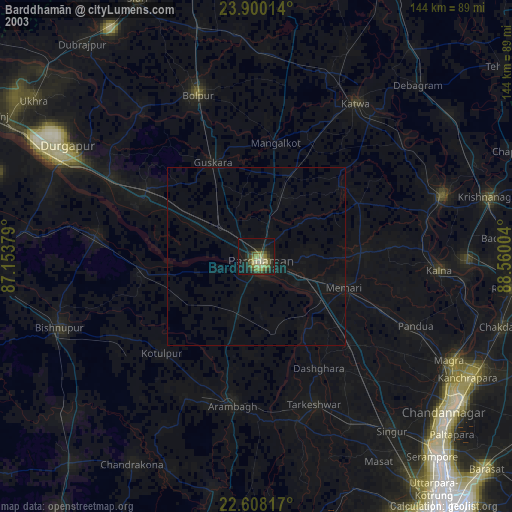
» NASA city lights 2003
» Earth at Night: Flat Maps 2012, 2016