Bāgeshwar night lights from space
Night Light of Bāgeshwar (Uttarakhand) from space (India) Src. Average luminocity for 10x10km area is 6.8175% and for 50x50km: 1.6903%.
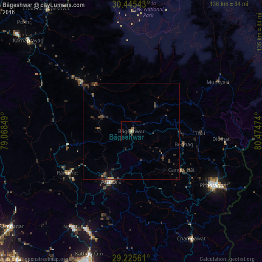
Analysis of Bāgeshwar night lights 2016
Square area 10x10 km:
 0%
0%90-99
0.2%80-89
1.19%70-79
0.99%60-69
0.79%50-59
3.97%40-49
1.59%30-39
0%20-29
1.79%10-19
0.6%0-9
88.89%Square area 50x50 km:
0.01%90-99
0.04%80-89
0.1%70-79
0.25%60-69
0.1%50-59
0.36%40-49
0.63%30-39
0.64%20-29
0.76%10-19
0.9%0-9
96.2%Clear (daylight) street map image can be seen on geolist.org.
Map coordinates:
30° 26' 43.5" North, 79° 4' 6.6" East
29° 50' 14.6" North, 79° 46' 17.8" East
29° 13' 32.2" North, 80° 28' 29.1" East
Some cities around Bāgeshwar sort by population:
• Pithorāgarh
50.8 km =31.6 mi,  123°
123°
• Naini Tāl
58.1 km =36.1 mi,  212°
212°
• Almora
28.8 km =17.9 mi,  202°
202°
• Rānikhet
39.4 km =24.5 mi,  236°
236°
• Dhārchula
72.1 km =44.8 mi,  89°
89°
• Lohaghāt
57.2 km =35.5 mi,  147°
147°
• Bhīm Tāl
58.4 km =36.3 mi, 200°
• Bhowali
56 km =34.8 mi, 207°
1277907 (p: 8,708)
Sources (retrieved 2019-11-25):
» Earth at Night: Flat Maps 2012, 2016