Āvadi night lights from space
Night Light of Āvadi (Tamil Nadu) from space (India) Src. Average luminocity for 10x10km area is 90.8615% and for 50x50km: 65.7872%.
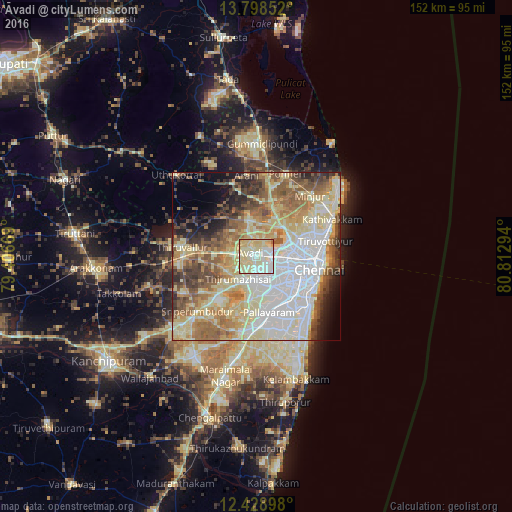
Analysis of Āvadi night lights 2016
Square area 10x10 km:
 17.75%
90-99
35.93%80-89
41.77%70-79
3.68%60-69
0.43%50-59
0.43%40-49
0%30-39
0%20-29
0%10-19
0%0-9
0%Square area 50x50 km:
15.87%90-99
15.75%80-89
15.81%70-79
5.93%60-69
8.37%50-59
9.61%40-49
6.25%30-39
4.92%20-29
4.66%10-19
4.37%0-9
8.47%Clear (daylight) street map image can be seen on geolist.org.
Map coordinates:
13° 47' 54.7" North, 79° 24' 24.1" East
13° 6' 52.9" North, 80° 6' 35.3" East
12° 25' 44.3" North, 80° 48' 46.6" East
Some cities around Āvadi sort by population:
• Ambattūr
5.9 km =3.7 mi,  108°
108°
• Poonamalle
7.3 km =4.5 mi,  175°
175°
• Porur
10.2 km =6.3 mi,  149°
149°
• Tinnanūr
9 km =5.6 mi,  269°
269°
• Nāravārikuppam
11.8 km =7.3 mi,  43°
43°
• Chetput
15 km =9.3 mi, 109°
• Manappakkam
13.2 km =8.2 mi, 151°
• Vellānūr
4.8 km =3 mi,  355°
355°
1278130 (p: 250,044)
Sources (retrieved 2019-11-25):
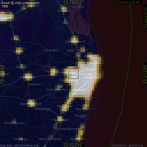
» NASA, Earths city lights 1995
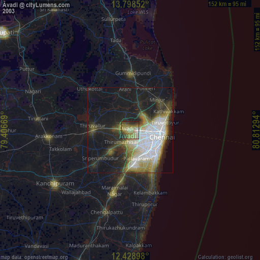
» NASA city lights 2003
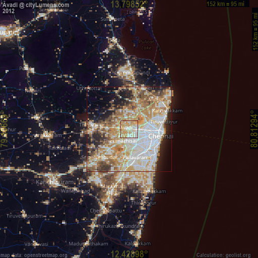
» Earth at Night: Flat Maps 2012, 2016