Chetput night lights from space
Night Light of Chetput (Tamil Nadu) from space (India) Src. Average luminocity for 10x10km area is 99.4545% and for 50x50km: 55.5823%.
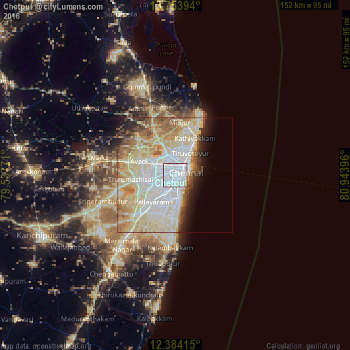
Analysis of Chetput night lights 2016
Square area 10x10 km:
 87.45%
90-99
10.39%80-89
1.73%70-79
0.43%60-69
0%50-59
0%40-49
0%30-39
0%20-29
0%10-19
0%0-9
0%Square area 50x50 km:
15.86%90-99
15.18%80-89
14.4%70-79
4.45%60-69
5.39%50-59
4.96%40-49
2.59%30-39
2.39%20-29
3.23%10-19
4.19%0-9
27.36%Clear (daylight) street map image can be seen on geolist.org.
Map coordinates:
13° 45' 14.2" North, 79° 32' 15.8" East
13° 4' 12" North, 80° 14' 27" East
12° 23' 2.9" North, 80° 56' 38.3" East
Some cities around Chetput sort by population:
• Chennai
4.5 km =2.8 mi,  64°
64°
• Ambattūr
9.1 km =5.7 mi,  290°
290°
• Alandur
8.4 km =5.2 mi,  206°
206°
• Saint Thomas Mount
8.9 km =5.5 mi, 213°
• Porur
9.7 km =6 mi,  246°
246°
• Chinnasekkadu
10.3 km =6.4 mi,  9°
9°
• Gāndhī Nagar
7.2 km =4.5 mi,  168°
168°
• Manappakkam
10.2 km =6.3 mi,  229°
229°
1274394 (p: 18,326)
Sources (retrieved 2019-11-25):
» Earth at Night: Flat Maps 2012, 2016