Arambol night lights from space
Night Light of Arambol (Goa) from space (India) Src. Average luminocity for 10x10km area is 19.6818% and for 50x50km: 16.3919%.
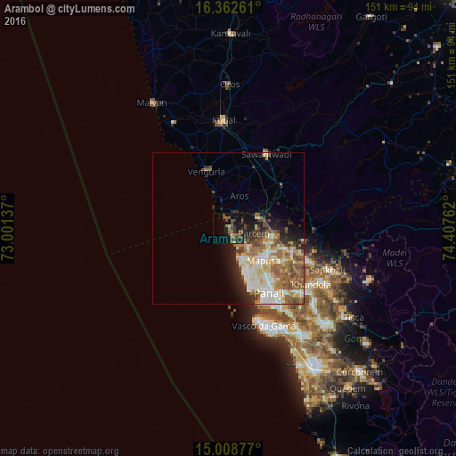
Analysis of Arambol night lights 2016
Square area 10x10 km:
 0%
0%90-99
0%80-89
1.73%70-79
0.43%60-69
2.16%50-59
9.96%40-49
7.14%30-39
8.01%20-29
4.55%10-19
15.58%0-9
50.43%Square area 50x50 km:
1.99%90-99
4.09%80-89
2.61%70-79
1.43%60-69
3.08%50-59
3.43%40-49
2.38%30-39
1.77%20-29
2.95%10-19
4.28%0-9
71.99%Clear (daylight) street map image can be seen on geolist.org.
Map coordinates:
16° 21' 45.4" North, 73° 0' 4.9" East
15° 41' 12.5" North, 73° 42' 16.2" East
15° 0' 31.6" North, 74° 24' 27.4" East
Some cities around Arambol sort by population:
• Māpuca
15.4 km =9.6 mi,  133°
133°
• Calangute
16.8 km =10.4 mi,  161°
161°
• Vagator
10.8 km =6.7 mi, 156°
• Solim
10.4 km =6.5 mi,  139°
139°
• Guirim
16.6 km =10.3 mi, 138°
• Saligao
17.4 km =10.8 mi,  148°
148°
• Colovale
14 km =8.7 mi,  114°
114°
• Pernem
10.5 km =6.5 mi,  67°
67°
1278464 (p: 10,000)
Sources (retrieved 2019-11-25):
» Earth at Night: Flat Maps 2012, 2016