Amudālavalasa night lights from space
Night Light of Amudālavalasa (Andhra Pradesh) from space (India) Src. Average luminocity for 10x10km area is 12.5413% and for 50x50km: 7.024%.
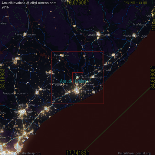
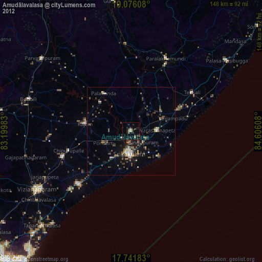
Analysis of Amudālavalasa night lights 2016
Square area 10x10 km:
 0%
0%90-99
0.83%80-89
1.65%70-79
0.62%60-69
0.41%50-59
2.27%40-49
2.48%30-39
4.75%20-29
2.69%10-19
20.04%0-9
64.26%Square area 50x50 km:
0.4%90-99
0.8%80-89
0.54%70-79
0.44%60-69
0.67%50-59
1.26%40-49
1.57%30-39
2.15%20-29
2.69%10-19
5.31%0-9
84.17%Clear (daylight) street map image can be seen on geolist.org.
Map coordinates:
19° 4' 33.9" North, 83° 11' 59.4" East
18° 24' 36.9" North, 83° 54' 10.6" East
17° 44' 30.6" North, 84° 36' 21.9" East
Some cities around Amudālavalasa sort by population:
• Srikakulam
12.4 km =7.7 mi,  182°
182°
• Bobbili
60.1 km =37.3 mi,  287°
287°
• Parlākimidi
45.6 km =28.3 mi,  25°
25°
• Pālkonda
26.5 km =16.5 mi,  324°
324°
• Rāzām
26 km =16.2 mi,  279°
279°
• Chīpurupalle
37 km =23 mi,  252°
252°
• Tekkali
41.2 km =25.6 mi,  58°
58°
• Narasannapeta
15 km =9.3 mi,  88°
88°
1278698 (p: 39,124)
Sources (retrieved 2019-11-25):
» Earth at Night: Flat Maps 2012, 2016