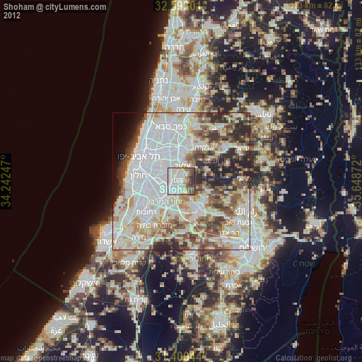
Shoham night lights from space
Night Light of Shoham (Central District) from space (Israel) Src. Average luminocity for 10x10km area is 84.0035% and for 50x50km: 72.1304%.
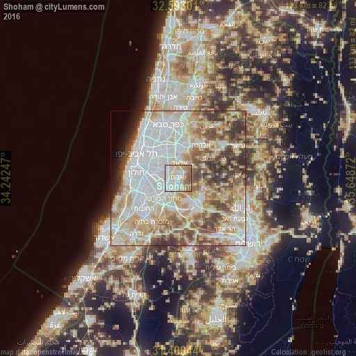
Analysis of Shoham night lights 2016
Square area 10x10 km:
 23.25%
90-99
26.92%80-89
17.31%70-79
7.52%60-69
8.92%50-59
12.24%40-49
3.85%30-39
0%20-29
0%10-19
0%0-9
0%Square area 50x50 km:
20.1%90-99
17.98%80-89
14.37%70-79
9.58%60-69
5.99%50-59
8.59%40-49
7.94%30-39
5.85%20-29
3.67%10-19
1.89%0-9
4.04%Clear (daylight) street map image can be seen on geolist.org.
Map coordinates:
32° 35' 34.8" North, 34° 14' 32.9" East
31° 59' 55.2" North, 34° 56' 44.1" East
31° 24' 1.6" North, 35° 38' 55.4" East
Some cities around Shoham sort by population:
• Lod
7.8 km =4.8 mi,  222°
222°
• Ramla
10.8 km =6.7 mi, 224°
• Rosh Ha‘Ayin
10.8 km =6.7 mi,  5°
5°
• Or Yehuda
8.9 km =5.5 mi,  292°
292°
• Yehud-Monosson
7 km =4.3 mi,  297°
297°
• Yehud
6.4 km =4 mi,  306°
306°
• Ganei Tikva
9.6 km =6 mi, 314°
• Bet Dagan
10.9 km =6.8 mi,  271°
271°
8428283 (p: 20,740)
Sources (retrieved 2019-11-25):
» Earth at Night: Flat Maps 2012, 2016