Yehud night lights from space
Night Light of Yehud (Central District) from space (Israel) Src. Average luminocity for 10x10km area is 96.6923% and for 50x50km: 65.0746%.
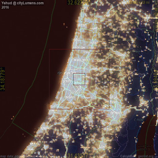
Analysis of Yehud night lights 2016
Square area 10x10 km:
 49.3%
49.3%90-99
35.66%80-89
15.03%70-79
0%60-69
0%50-59
0%40-49
0%30-39
0%20-29
0%10-19
0%0-9
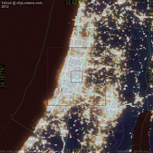
0%Square area 50x50 km:
18.58%90-99
16.49%80-89
12.77%70-79
8.28%60-69
5.28%50-59
7.77%40-49
6.32%30-39
4.77%20-29
3.67%10-19
2.89%0-9
13.18%Clear (daylight) street map image can be seen on geolist.org.
Map coordinates:
32° 37' 38.2" North, 34° 11' 16" East
32° 1' 59.4" North, 34° 53' 27.3" East
31° 26' 6.6" North, 35° 35' 38.5" East
Some cities around Yehud sort by population:
• Petaẖ Tiqwa
6 km =3.7 mi,  356°
356°
• Bnei Brak
7.5 km =4.7 mi,  314°
314°
• Or Yehuda
3.1 km =1.9 mi,  261°
261°
• Shoham
6.4 km =4 mi,  126°
126°
• Giv'at Shmuel
6.4 km =4 mi,  321°
321°
• Azor
8 km =5 mi, 262°
• Ganei Tikva
3.4 km =2.1 mi,  330°
330°
• Bet Dagan
6.7 km =4.2 mi,  238°
238°
293207 (p: 25,600)
Sources (retrieved 2019-11-25):
» Earth at Night: Flat Maps 2012, 2016