Trá Mhór night lights from space
Night Light of Trá Mhór (Munster) from space (Ireland) Src. Average luminocity for 10x10km area is 8.0026% and for 50x50km: 2.7327%.
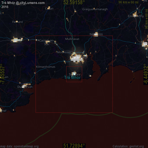
Analysis of Trá Mhór night lights 2016
Square area 10x10 km:
 1.19%
1.19%90-99
1.46%80-89
1.06%70-79
0.53%60-69
0%50-59
0%40-49
0.53%30-39
0.79%20-29
0.79%10-19
10.32%0-9
83.33%Square area 50x50 km:
0.44%90-99
0.59%80-89
0.28%70-79
0.21%60-69
0.26%50-59
0.17%40-49
0.27%30-39
0.31%20-29
0.77%10-19
2.44%0-9
94.26%Clear (daylight) street map image can be seen on geolist.org.
Map coordinates:
52° 35' 29.7" North, 7° 51' 20.1" West
52° 9' 44.5" North, 7° 9' 8.8" West
51° 43' 44.2" North, 6° 26' 57.6" West
Some cities around Trá Mhór sort by population:
• Waterford
11 km =6.8 mi,  14°
14°
• Kilkenny
55.1 km =34.2 mi,  352°
352°
• Loch Garman
51 km =31.7 mi,  68°
68°
• Cluain Meala
43.2 km =26.8 mi,  299°
299°
• Dungarvan
33.3 km =20.7 mi,  255°
255°
• Youghal
53.3 km =33.1 mi,  243°
243°
• New Ross
29.9 km =18.6 mi,  29°
29°
• Carrick-on-Suir
27.3 km =17 mi,  319°
319°
2961120 (p: 9,164)
Sources (retrieved 2019-11-25):
» Earth at Night: Flat Maps 2012, 2016