Serang night lights from space
Night Light of Serang (Banten) from space (Indonesia) Src. Average luminocity for 10x10km area is 54.6591% and for 50x50km: 20.2094%.
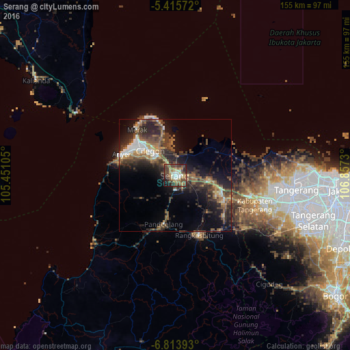
Analysis of Serang night lights 2016
Square area 10x10 km:
 4.96%
4.96%90-99
8.88%80-89
9.09%70-79
5.79%60-69
12.6%50-59
8.88%40-49
19.63%30-39
10.74%20-29
11.16%10-19
7.85%0-9
0.41%Square area 50x50 km:
1.83%90-99
2.22%80-89
1.72%70-79
2.09%60-69
3.73%50-59
4.19%40-49
5.08%30-39
5.45%20-29
7.66%10-19
11.29%0-9
54.72%Clear (daylight) street map image can be seen on geolist.org.
Map coordinates:
5° 24' 56.6" South, 105° 27' 3.8" East
6° 6' 55" South, 106° 9' 15" East
6° 48' 50.1" South, 106° 51' 26.3" East
Some cities around Serang sort by population:
• Curug
47.5 km =29.5 mi,  110°
110°
• Cikupa
41.4 km =25.7 mi, 108°
• Pasarkemis
42 km =26.1 mi,  98°
98°
• Rangkasbitung
29.1 km =18.1 mi,  158°
158°
• Sepatan
46.5 km =28.9 mi,  90°
90°
• Kresek
25 km =15.5 mi, 94°
• Pandeglang
22.1 km =13.7 mi,  193°
193°
• Labuan
46.3 km =28.8 mi,  230°
230°
1627549 (p: 164,767)
Sources (retrieved 2019-11-25):
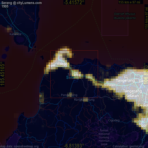
» NASA, Earths city lights 1995
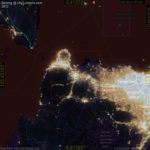
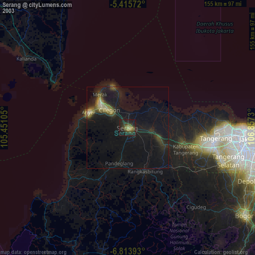
» NASA city lights 2003
» Earth at Night: Flat Maps 2012, 2016