Pasarkemis night lights from space
Night Light of Pasarkemis (West Java) from space (Indonesia) Src. Average luminocity for 10x10km area is 84.25% and for 50x50km: 47.5507%.
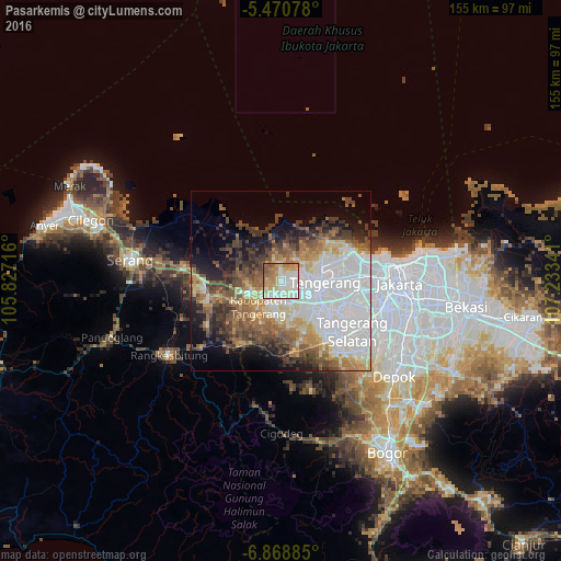
Analysis of Pasarkemis night lights 2016
Square area 10x10 km:
 17.77%
90-99
31.82%80-89
14.88%70-79
14.05%60-69
11.78%50-59
7.02%40-49
2.69%30-39
0%20-29
0%10-19
0%0-9
0%Square area 50x50 km:
17.25%90-99
7.25%80-89
4.66%70-79
5.08%60-69
5.86%50-59
6.57%40-49
7.05%30-39
5.84%20-29
5.38%10-19
7.83%0-9
27.24%Clear (daylight) street map image can be seen on geolist.org.
Map coordinates:
5° 28' 14.8" South, 105° 49' 37.8" East
6° 10' 13" South, 106° 31' 49" East
6° 52' 7.9" South, 107° 14' 0.3" East
Some cities around Pasarkemis sort by population:
• Tangerang
11.1 km =6.9 mi,  94°
94°
• Ciputat
19.7 km =12.2 mi,  112°
112°
• Curug
11 km =6.8 mi,  164°
164°
• Cikupa
7.7 km =4.8 mi,  198°
198°
• Teluknaga
14.3 km =8.9 mi,  56°
56°
• Sepatan
7.6 km =4.7 mi,  40°
40°
• Kresek
17.2 km =10.7 mi,  284°
284°
• Serpong
22 km =13.7 mi,  137°
137°
1632228 (p: 154,234)
Sources (retrieved 2019-11-25):
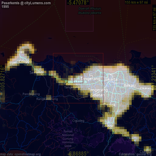
» NASA, Earths city lights 1995
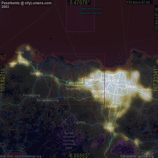
» NASA city lights 2003
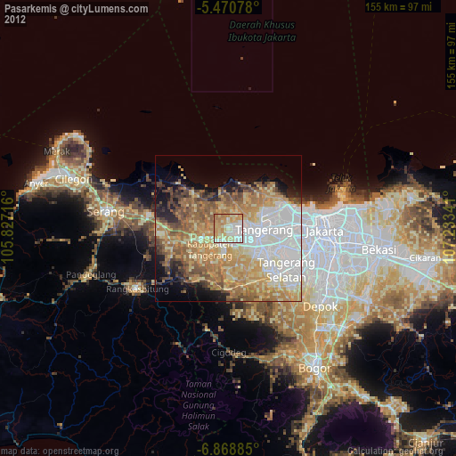
» Earth at Night: Flat Maps 2012, 2016