Curug night lights from space
Night Light of Curug (Banten) from space (Indonesia) Src. Average luminocity for 10x10km area is 84.1991% and for 50x50km: 53.419%.
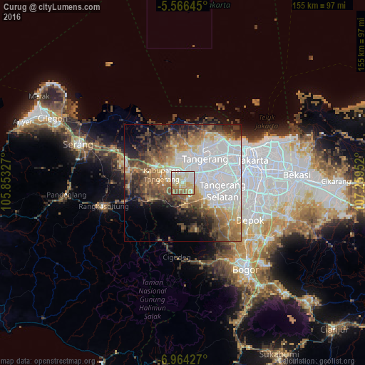
Analysis of Curug night lights 2016
Square area 10x10 km:
 17.75%
90-99
25.97%80-89
23.38%70-79
13.85%60-69
9.52%50-59
8.87%40-49
0.65%30-39
0%20-29
0%10-19
0%0-9
0%Square area 50x50 km:
20.03%90-99
8.14%80-89
5.11%70-79
5.57%60-69
7.01%50-59
7.57%40-49
7.68%30-39
5.81%20-29
6.2%10-19
7.46%0-9
19.42%Clear (daylight) street map image can be seen on geolist.org.
Map coordinates:
5° 33' 59.2" South, 105° 51' 11.8" East
6° 15' 57" South, 106° 33' 23" East
6° 57' 51.4" South, 107° 15' 34.3" East
Some cities around Curug sort by population:
• Tangerang
12.7 km =7.9 mi,  39°
39°
• South Tangerang
18 km =11.2 mi,  98°
98°
• Ciputat
15.7 km =9.8 mi,  78°
78°
• Cikupa
6.2 km =3.9 mi,  301°
301°
• Pasarkemis
11 km =6.8 mi,  344°
344°
• Teluknaga
20.6 km =12.8 mi,  25°
25°
• Sepatan
16.5 km =10.3 mi,  7°
7°
• Serpong
13.2 km =8.2 mi,  115°
115°
1645895 (p: 191,406)
Sources (retrieved 2019-11-25):
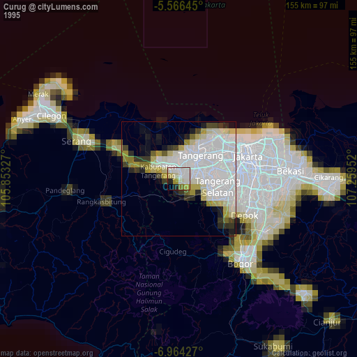
» NASA, Earths city lights 1995
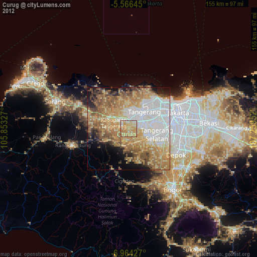
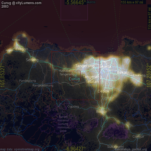
» NASA city lights 2003
» Earth at Night: Flat Maps 2012, 2016