Lawang night lights from space
Night Light of Lawang (East Java) from space (Indonesia) Src. Average luminocity for 10x10km area is 33.5083% and for 50x50km: 27.6501%.
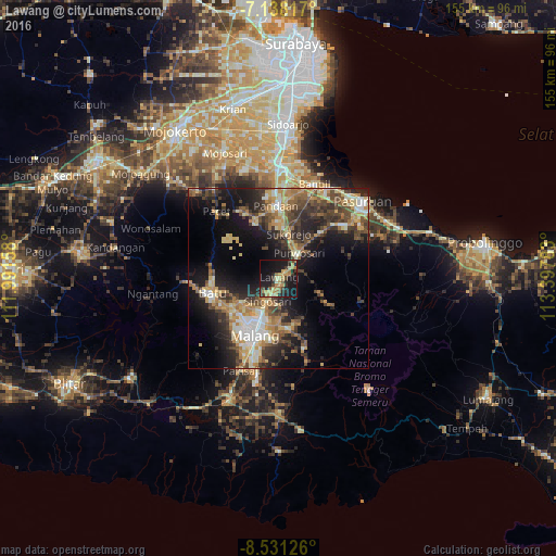
Analysis of Lawang night lights 2016
Square area 10x10 km:
 0%
0%90-99
2.48%80-89
5.58%70-79
9.3%60-69
8.88%50-59
2.69%40-49
4.34%30-39
4.75%20-29
11.36%10-19
39.26%0-9
11.36%Square area 50x50 km:
1.96%90-99
4.44%80-89
4.2%70-79
4.64%60-69
4.5%50-59
3.49%40-49
5.68%30-39
5.89%20-29
7.85%10-19
15.88%0-9
41.46%Clear (daylight) street map image can be seen on geolist.org.
Map coordinates:
7° 8' 17.4" South, 111° 59' 29.7" East
7° 50' 7.1" South, 112° 41' 40.9" East
8° 31' 52.5" South, 113° 23' 52.2" East
Some cities around Lawang sort by population:
• Malang
17.5 km =10.9 mi,  203°
203°
• Pasuruan
31.6 km =19.6 mi,  47°
47°
• Bangil
29.6 km =18.4 mi,  27°
27°
• Batu
18.7 km =11.6 mi,  258°
258°
• Singosari
7.1 km =4.4 mi,  206°
206°
• Pandaan
20.3 km =12.6 mi,  357°
357°
• Pakisaji
27.8 km =17.3 mi, 202°
• Prigen
19 km =11.8 mi,  333°
333°
1638284 (p: 159,380)
Sources (retrieved 2019-11-25):
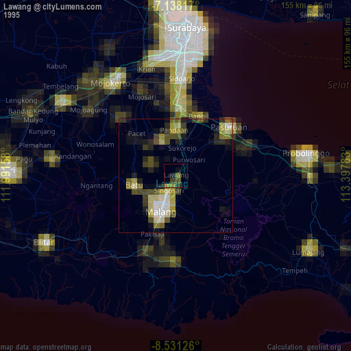
» NASA, Earths city lights 1995
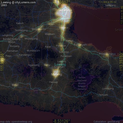
» NASA city lights 2003
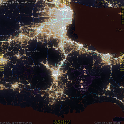
» Earth at Night: Flat Maps 2012, 2016