Batu night lights from space
Night Light of Batu (East Java) from space (Indonesia) Src. Average luminocity for 10x10km area is 46.7211% and for 50x50km: 20.6244%.
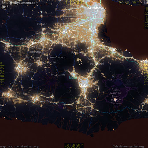
Analysis of Batu night lights 2016
Square area 10x10 km:
 4.34%
4.34%90-99
6.4%80-89
8.88%70-79
11.36%60-69
8.68%50-59
3.93%40-49
6.2%30-39
7.64%20-29
10.95%10-19
29.96%0-9
1.65%Square area 50x50 km:
1.62%90-99
3.26%80-89
3.25%70-79
3.32%60-69
3.8%50-59
2.14%40-49
3.24%30-39
4.21%20-29
6.05%10-19
12.39%0-9
56.72%Clear (daylight) street map image can be seen on geolist.org.
Map coordinates:
7° 10' 22.5" South, 111° 49' 30.8" East
7° 52' 12" South, 112° 31' 42" East
8° 33' 57.2" South, 113° 13' 53.3" East
Some cities around Batu sort by population:
• Malang
16.6 km =10.3 mi,  137°
137°
• Lawang
18.7 km =11.6 mi,  78°
78°
• Singosari
15.3 km =9.5 mi,  99°
99°
• Kepanjen
29.4 km =18.3 mi,  170°
170°
• Sumberpucung
32.5 km =20.2 mi,  188°
188°
• Pandaan
29.9 km =18.6 mi,  35°
35°
• Pakisaji
23.2 km =14.4 mi,  160°
160°
• Prigen
22.9 km =14.2 mi,  25°
25°
1649824 (p: 75,631)
Sources (retrieved 2019-11-25):
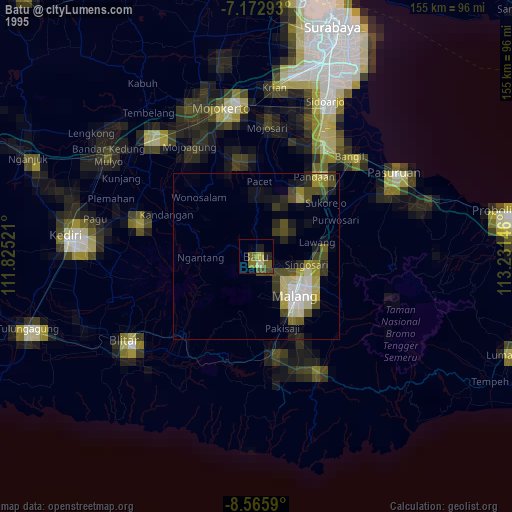
» NASA, Earths city lights 1995
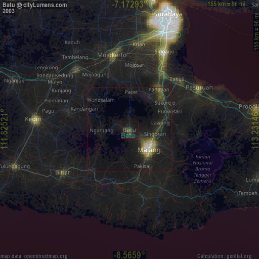
» NASA city lights 2003
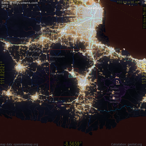
» Earth at Night: Flat Maps 2012, 2016