Szigethalom night lights from space
Night Light of Szigethalom (Pest) from space (Hungary) Src. Average luminocity for 10x10km area is 31.4449% and for 50x50km: 24.6581%.
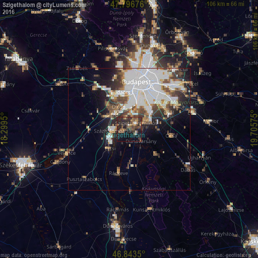
Analysis of Szigethalom night lights 2016
Square area 10x10 km:
 1.64%
1.64%90-99
1.34%80-89
1.49%70-79
3.27%60-69
4.91%50-59
9.82%40-49
7.44%30-39
11.46%20-29
19.49%10-19
26.34%0-9
12.8%Square area 50x50 km:
8.85%90-99
4.53%80-89
1.59%70-79
2.1%60-69
2.25%50-59
2.63%40-49
3.47%30-39
3.42%20-29
4.44%10-19
7.74%0-9
58.97%Clear (daylight) street map image can be seen on geolist.org.
Map coordinates:
47° 47' 48.3" North, 18° 17' 58.2" East
47° 19' 20.2" North, 19° 0' 9.4" East
46° 50' 36.6" North, 19° 42' 20.7" East
Some cities around Szigethalom sort by population:
• Érd
10.5 km =6.5 mi,  320°
320°
• Százhalombatta
4.9 km =3 mi,  279°
279°
• Dunaharaszti
8 km =5 mi,  63°
63°
• Tököl
3 km =1.9 mi,  268°
268°
• Halásztelek
4.7 km =2.9 mi,  339°
339°
• Diósd
10.5 km =6.5 mi, 337°
• Taksony
4.9 km =3 mi,  80°
80°
• Dunavarsány
6.8 km =4.2 mi,  135°
135°
3044487 (p: 13,092)
Sources (retrieved 2019-11-25):
» Earth at Night: Flat Maps 2012, 2016