Szeghalom night lights from space
Night Light of Szeghalom (Bekes) from space (Hungary) Src. Average luminocity for 10x10km area is 3.2642% and for 50x50km: 0.4803%.
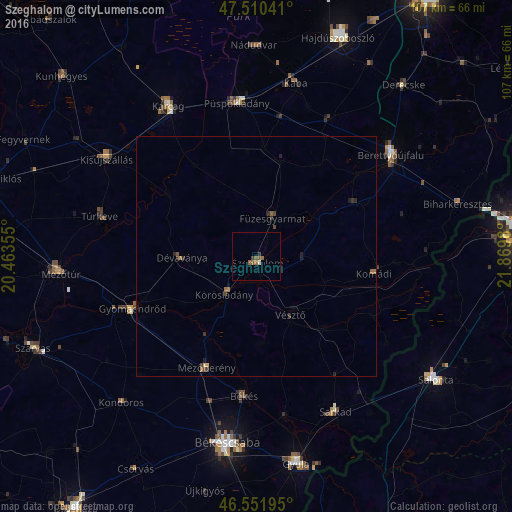
Analysis of Szeghalom night lights 2016
Square area 10x10 km:
 0%
0%90-99
0.57%80-89
0%70-79
0%60-69
0%50-59
3.27%40-49
0.28%30-39
0.99%20-29
0%10-19
0%0-9
94.89%Square area 50x50 km:
0%90-99
0.02%80-89
0.04%70-79
0.01%60-69
0.11%50-59
0.2%40-49
0.11%30-39
0.2%20-29
0.15%10-19
0.14%0-9
99.02%Clear (daylight) street map image can be seen on geolist.org.
Map coordinates:
47° 30' 37.5" North, 20° 27' 48.8" East
47° 1' 60" North, 21° 10' 0" East
46° 33' 7" North, 21° 52' 11.3" East
Some cities around Szeghalom sort by population:
• Békés
29.8 km =18.5 mi,  184°
184°
• Gyomaendrőd
27.6 km =17.1 mi,  246°
246°
• Mezőberény
26.1 km =16.2 mi,  202°
202°
• Dévaványa
15.2 km =9.4 mi,  270°
270°
• Vésztő
15 km =9.3 mi,  149°
149°
• Füzesgyarmat
8.3 km =5.2 mi,  27°
27°
• Komádi
25.5 km =15.8 mi,  98°
98°
• Körösladány
9.7 km =6 mi,  220°
220°
715422 (p: 9,985)
Sources (retrieved 2019-11-25):
» Earth at Night: Flat Maps 2012, 2016