El Tejar night lights from space
Night Light of El Tejar (Chimaltenango) from space (Guatemala) Src. Average luminocity for 10x10km area is 27.2056% and for 50x50km: 16.9703%.
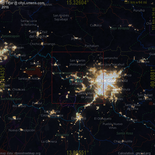
Analysis of El Tejar night lights 2016
Square area 10x10 km:
 0.43%
0.43%90-99
0.87%80-89
3.9%70-79
3.68%60-69
8.87%50-59
6.49%40-49
3.25%30-39
1.95%20-29
6.49%10-19
49.13%0-9
14.94%Square area 50x50 km:
2.15%90-99
2.92%80-89
2.51%70-79
2%60-69
3.1%50-59
2.28%40-49
2.32%30-39
2.6%20-29
3.8%10-19
10.53%0-9
65.79%Clear (daylight) street map image can be seen on geolist.org.
Map coordinates:
15° 19' 33.7" North, 91° 29' 39.7" West
14° 38' 48.6" North, 90° 47' 28.4" West
13° 57' 55.8" North, 90° 5' 17.2" West
Some cities around El Tejar sort by population:
• Chimaltenango
3.4 km =2.1 mi,  297°
297°
• Sumpango
6.1 km =3.8 mi,  90°
90°
• San Andrés Itzapa
6.2 km =3.9 mi,  243°
243°
• Jocotenango
9.5 km =5.9 mi,  143°
143°
• Pastores
7 km =4.3 mi,  146°
146°
• Parramos
4.4 km =2.7 mi,  196°
196°
• Zaragoza
10.7 km =6.6 mi,  271°
271°
• Santo Domingo Xenacoj
10.5 km =6.5 mi,  69°
69°
3596041 (p: 15,770)
Sources (retrieved 2019-11-25):
» Earth at Night: Flat Maps 2012, 2016