Polýgyros night lights from space
Night Light of Polýgyros (Central Macedonia) from space (Greece) Src. Average luminocity for 10x10km area is 6.1752% and for 50x50km: 3.054%.
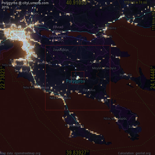
Analysis of Polýgyros night lights 2016
Square area 10x10 km:
 0.85%
0.85%90-99
2.55%80-89
0.34%70-79
0.34%60-69
0.68%50-59
0%40-49
0.68%30-39
0%20-29
0.68%10-19
0%0-9
93.88%Square area 50x50 km:
0.09%90-99
0.45%80-89
0.3%70-79
0.27%60-69
0.57%50-59
0.51%40-49
0.54%30-39
0.83%20-29
0.68%10-19
0.55%0-9
95.21%Clear (daylight) street map image can be seen on geolist.org.
Map coordinates:
40° 54' 38" North, 22° 44' 17.6" East
40° 22' 37.3" North, 23° 26' 28.9" East
39° 50' 21.4" North, 24° 8' 40.1" East
Some cities around Polýgyros sort by population:
• Panórama
41.8 km =26 mi,  304°
304°
• Peraía
45.6 km =28.3 mi,  287°
287°
• Thérmi
40.4 km =25.1 mi, 297°
• Néa Moudhaniá
19.9 km =12.4 mi,  221°
221°
• Epanomí
43.8 km =27.2 mi,  277°
277°
• Néa Kallikráteia
32.8 km =20.4 mi,  257°
257°
• Trílofos
41 km =25.5 mi, 284°
• Plagiári
42.3 km =26.3 mi, 284°
734517 (p: 10,000)
Sources (retrieved 2019-11-25):
» Earth at Night: Flat Maps 2012, 2016