Ovriá night lights from space
Night Light of Ovriá (West Greece) from space (Greece) Src. Average luminocity for 10x10km area is 51.6956% and for 50x50km: 11.7842%.
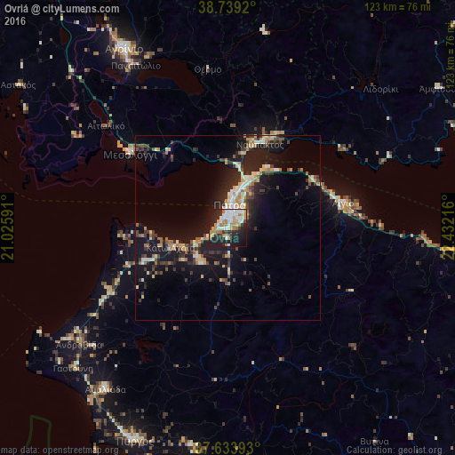
Analysis of Ovriá night lights 2016
Square area 10x10 km:
 7.14%
7.14%90-99
14.46%80-89
6.8%70-79
6.97%60-69
12.41%50-59
1.19%40-49
1.87%30-39
4.42%20-29
22.62%10-19
20.41%0-9
1.7%Square area 50x50 km:
0.86%90-99
2.13%80-89
1.31%70-79
1.42%60-69
1.81%50-59
1.01%40-49
1.28%30-39
2.58%20-29
4.19%10-19
11.22%0-9
72.19%Clear (daylight) street map image can be seen on geolist.org.
Map coordinates:
38° 44' 21.1" North, 21° 1' 33.3" East
38° 11' 19.2" North, 21° 43' 44.5" East
37° 38' 2.1" North, 22° 25' 55.8" East
Some cities around Ovriá sort by population:
• Pátra
6.2 km =3.9 mi,  4°
4°
• Agrínio
55.7 km =34.6 mi,  329°
329°
• Aígio
31.5 km =19.6 mi,  77°
77°
• Amaliáda
54.6 km =33.9 mi,  217°
217°
• Náfpaktos
24.2 km =15 mi,  20°
20°
• Mesolóngi
33 km =20.5 mi,  308°
308°
• Paralía
2.5 km =1.6 mi,  294°
294°
• Káto Achaḯa
16.2 km =10.1 mi,  254°
254°
256223 (p: 5,838)
Sources (retrieved 2019-11-25):
» Earth at Night: Flat Maps 2012, 2016