Lávrio night lights from space
Night Light of Lávrio (Attica) from space (Greece) Src. Average luminocity for 10x10km area is 27.1956% and for 50x50km: 13.7298%.
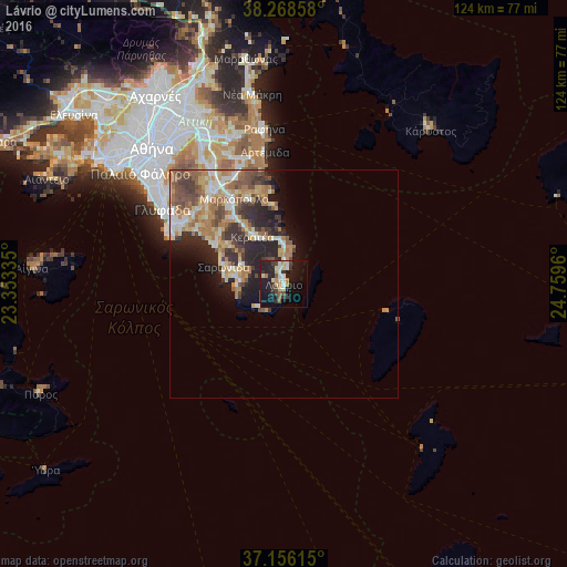
Analysis of Lávrio night lights 2016
Square area 10x10 km:
 2.72%
2.72%90-99
4.93%80-89
4.25%70-79
2.55%60-69
2.04%50-59
2.21%40-49
2.72%30-39
5.27%20-29
11.39%10-19
32.48%0-9
29.42%Square area 50x50 km:
1.26%90-99
2.4%80-89
1.89%70-79
2%60-69
3.11%50-59
2.2%40-49
2.26%30-39
2.32%20-29
4.07%10-19
5.61%0-9
72.88%Clear (daylight) street map image can be seen on geolist.org.
Map coordinates:
38° 16' 6.9" North, 23° 21' 12.1" East
37° 42' 52" North, 24° 3' 23.3" East
37° 9' 22.1" North, 24° 45' 34.6" East
Some cities around Lávrio sort by population:
• Voúla
28.4 km =17.6 mi,  300°
300°
• Koropí
26.1 km =16.2 mi,  321°
321°
• Vári
25.9 km =16.1 mi, 300°
• Kalývia Thorikoú
18 km =11.2 mi, 320°
• Limín Mesoyaías
20.2 km =12.6 mi,  346°
346°
• Markópoulo
21.7 km =13.5 mi,  330°
330°
• Keratéa
12.3 km =7.6 mi, 325°
• Anávyssos
10.1 km =6.3 mi,  282°
282°
258543 (p: 7,078)
Sources (retrieved 2019-11-25):
» Earth at Night: Flat Maps 2012, 2016