Archángelos night lights from space
Night Light of Archángelos (South Aegean) from space (Greece) Src. Average luminocity for 10x10km area is 20.8514% and for 50x50km: 8.0087%.
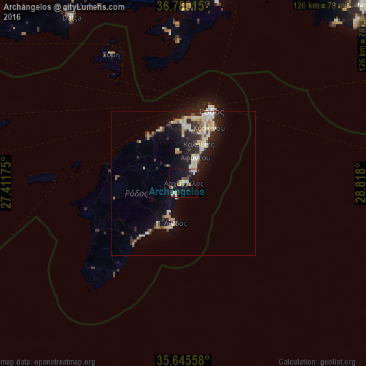
Analysis of Archángelos night lights 2016
Square area 10x10 km:
 2.1%
2.1%90-99
3.85%80-89
1.75%70-79
3.85%60-69
1.4%50-59
3.85%40-49
1.05%30-39
3.15%20-29
2.45%10-19
18.88%0-9
57.69%Square area 50x50 km:
0.56%90-99
1.82%80-89
1.09%70-79
1.48%60-69
0.54%50-59
0.63%40-49
0.82%30-39
1.15%20-29
2.43%10-19
5.64%0-9
83.86%Clear (daylight) street map image can be seen on geolist.org.
Map coordinates:
36° 46' 48.5" North, 27° 24' 42.3" East
36° 12' 53.7" North, 28° 6' 53.5" East
35° 38' 44.1" North, 28° 49' 4.8" East
Some cities around Archángelos sort by population:
• Ródos
26.3 km =16.3 mi,  21°
21°
• Marmaris, TR
72.6 km =45.1 mi,  11°
11°
• Dalaman, TR
86.8 km =53.9 mi,  45°
45°
• Sarigerme, TR
76.7 km =47.7 mi,  43°
43°
• Ialysós
22.4 km =13.9 mi, 9°
• Datça, TR
69.7 km =43.3 mi,  326°
326°
• Faliraki
15.8 km =9.8 mi,  28°
28°
• Afántou
9.7 km =6 mi, 25°
408686 (p: 5,398)
Sources (retrieved 2019-11-25):
» Earth at Night: Flat Maps 2012, 2016