Sarigerme night lights from space
Night Light of Sarigerme (Muğla) from space (Turkey) Src. Average luminocity for 10x10km area is 11.0952% and for 50x50km: 6.0536%.
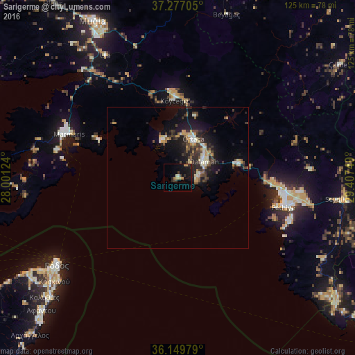
Analysis of Sarigerme night lights 2016
Square area 10x10 km:
 0%
0%90-99
0.73%80-89
1.65%70-79
3.48%60-69
0.73%50-59
0%40-49
0.73%30-39
2.38%20-29
2.93%10-19
12.45%0-9
74.91%Square area 50x50 km:
0.31%90-99
0.95%80-89
0.76%70-79
1.05%60-69
0.25%50-59
0.54%40-49
1.25%30-39
1.38%20-29
1.85%10-19
5.38%0-9
86.27%Clear (daylight) street map image can be seen on geolist.org.
Map coordinates:
37° 16' 37.4" North, 28° 0' 4.5" East
36° 42' 55.8" North, 28° 42' 15.7" East
36° 8' 59.2" North, 29° 24' 27" East
Some cities around Sarigerme sort by population:
• Fethiye
38.7 km =24 mi,  102°
102°
• Ródos, GR
53.1 km =33 mi,  234°
234°
• Marmaris
41.3 km =25.7 mi,  292°
292°
• Ortaca
14.8 km =9.2 mi,  21°
21°
• Dalaman
10.4 km =6.5 mi,  57°
57°
• Ialysós, GR
59.4 km =36.9 mi,  235°
235°
• Faliraki, GR
61.5 km =38.2 mi, 227°
• Ula
50.3 km =31.3 mi,  329°
329°
6692524 (p: 16,000)
Sources (retrieved 2019-11-25):
» Earth at Night: Flat Maps 2012, 2016