Agriá night lights from space
Night Light of Agriá (Thessaly) from space (Greece) Src. Average luminocity for 10x10km area is 31.0119% and for 50x50km: 7.7197%.
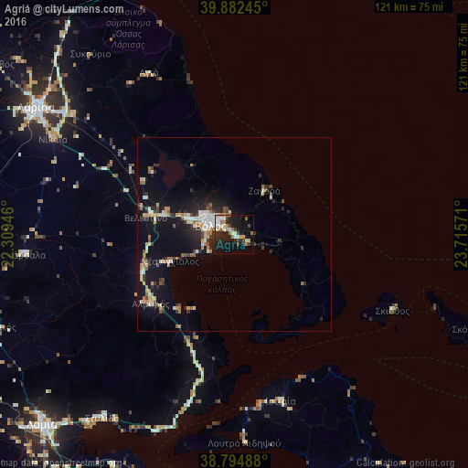
Analysis of Agriá night lights 2016
Square area 10x10 km:
 2.55%
2.55%90-99
8.16%80-89
2.21%70-79
4.25%60-69
5.95%50-59
1.36%40-49
1.53%30-39
4.59%20-29
11.9%10-19
28.74%0-9
28.74%Square area 50x50 km:
0.51%90-99
1.58%80-89
0.83%70-79
0.91%60-69
1.28%50-59
0.59%40-49
0.65%30-39
1.18%20-29
2.24%10-19
7.52%0-9
82.7%Clear (daylight) street map image can be seen on geolist.org.
Map coordinates:
39° 52' 56.8" North, 22° 18' 34.1" East
39° 20' 26.8" North, 23° 0' 45.3" East
38° 47' 41.6" North, 23° 42' 56.6" East
Some cities around Agriá sort by population:
• Lárisa
60.7 km =37.7 mi,  302°
302°
• Volos
6.4 km =4 mi,  290°
290°
• Néa Ionía
8.5 km =5.3 mi, 300°
• Fársala
54.3 km =33.7 mi,  264°
264°
• Almyrós
28 km =17.4 mi,  231°
231°
• Giánnouli
64.2 km =39.9 mi, 304°
• Néa Anchiálos
18 km =11.2 mi,  248°
248°
• Skiáthos
45.7 km =28.4 mi,  115°
115°
265601 (p: 5,519)
Sources (retrieved 2019-11-25):
» Earth at Night: Flat Maps 2012, 2016