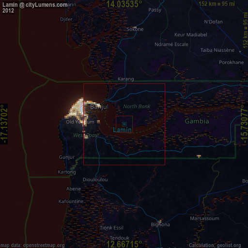
Lamin night lights from space
Night Light of Lamin (North Bank) from space (Gambia) Src. Average luminocity for 10x10km area is 0% and for 50x50km: 2.286%.
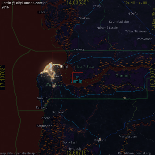
Analysis of Lamin night lights 2016
Square area 10x10 km:
100  0%
0%
90-99 0%
80-89 0%
70-79 0%
60-69 0%
50-59 0%
40-49 0%
30-39 0%
20-29 0%
10-19 0%
0-9 100%
0%90-99
0%80-89
0%70-79
0%60-69
0%50-59
0%40-49
0%30-39
0%20-29
0%10-19
0%0-9
100%Square area 50x50 km:
100 0.1%
90-99 0.13%
80-89 0.14%
70-79 0.52%
60-69 0.32%
50-59 0.28%
40-49 0.68%
30-39 0.41%
20-29 0.83%
10-19 2.19%
0-9 94.39%
0.1%90-99
0.13%80-89
0.14%70-79
0.52%60-69
0.32%50-59
0.28%40-49
0.68%30-39
0.41%20-29
0.83%10-19
2.19%0-9
94.39%Clear (daylight) street map image can be seen on geolist.org.
Map coordinates:
14° 2' 7.3" North, 17° 8' 13.3" West
13° 21' 8" North, 16° 26' 2" West
12° 40' 1.7" North, 15° 43' 50.8" West
Some cities around Lamin sort by population:
• Serekunda
28.1 km =17.5 mi,  289°
289°
• Brikama
25 km =15.5 mi,  248°
248°
• Bakau
30.3 km =18.8 mi,  297°
297°
• Banjul
19.2 km =11.9 mi,  305°
305°
• Sukuta
30.4 km =18.9 mi,  282°
282°
• Abuko
24.7 km =15.3 mi, 283°
• Essau
18.3 km =11.4 mi,  323°
323°
• Barra
18.9 km =11.7 mi, 320°
2412749 (p: 24,797)
Sources (retrieved 2019-11-25):
» Earth at Night: Flat Maps 2012, 2016