Aboso night lights from space
Night Light of Aboso (Western) from space (Ghana) Src. Average luminocity for 10x10km area is 11.6074% and for 50x50km: 5.2809%.
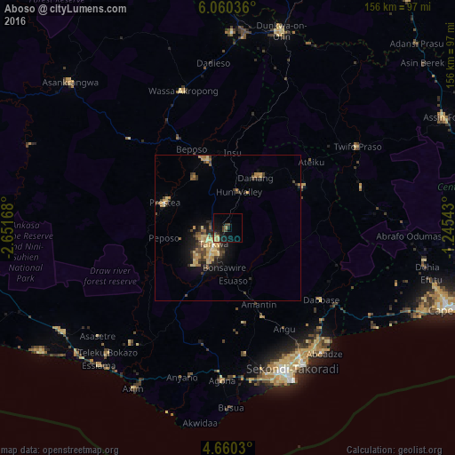
Analysis of Aboso night lights 2016
Square area 10x10 km:
 0%
0%90-99
0%80-89
1.65%70-79
2.89%60-69
2.07%50-59
0%40-49
4.34%30-39
1.24%20-29
3.51%10-19
15.7%0-9
68.6%Square area 50x50 km:
0.04%90-99
0.06%80-89
1.36%70-79
1.17%60-69
1.03%50-59
0.39%40-49
1.39%30-39
1.05%20-29
1.17%10-19
3.34%0-9
89.01%Clear (daylight) street map image can be seen on geolist.org.
Map coordinates:
6° 3' 37.3" North, 2° 39' 6" West
5° 21' 38.6" North, 1° 56' 54.8" West
4° 39' 37.1" North, 1° 14' 43.5" West
Some cities around Aboso sort by population:
• Takoradi
55.5 km =34.5 mi,  157°
157°
• Sekondi-Takoradi
52.7 km =32.7 mi, 156°
• Prestea
23 km =14.3 mi,  290°
290°
• Tarkwa
7.8 km =4.8 mi,  215°
215°
• Dunkwa
69.3 km =43.1 mi,  15°
15°
• Elmina
72.9 km =45.3 mi,  114°
114°
• Axim
63.8 km =39.6 mi,  210°
210°
• Shama Junction
49.4 km =30.7 mi,  140°
140°
2306224 (p: 8,790)
Sources (retrieved 2019-11-25):
» Earth at Night: Flat Maps 2012, 2016