Tsnori night lights from space
Night Light of Tsnori (Kakheti) from space (Georgia) Src. Average luminocity for 10x10km area is 4.5308% and for 50x50km: 0.9219%.
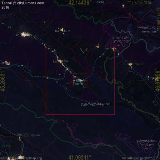
Analysis of Tsnori night lights 2016
Square area 10x10 km:
 0%
0%90-99
0%80-89
0%70-79
0.16%60-69
1.14%50-59
1.3%40-49
2.6%30-39
1.3%20-29
2.27%10-19
1.79%0-9
89.45%Square area 50x50 km:
0%90-99
0.01%80-89
0.03%70-79
0.06%60-69
0.11%50-59
0.23%40-49
0.48%30-39
0.2%20-29
0.65%10-19
0.39%0-9
97.83%Clear (daylight) street map image can be seen on geolist.org.
Map coordinates:
42° 8' 39.7" North, 45° 15' 58.7" East
41° 37' 15.2" North, 45° 58' 9.9" East
41° 5' 35.2" North, 46° 40' 21.2" East
Some cities around Tsnori sort by population:
• Telavi
52.9 km =32.9 mi,  308°
308°
• Zaqatala, AZ
56.1 km =34.9 mi,  88°
88°
• Sagarejo
54.5 km =33.9 mi,  283°
283°
• Gurjaani
19.5 km =12.1 mi, 314°
• Belokany, AZ
38 km =23.6 mi,  72°
72°
• Aliabad, AZ
57.5 km =35.7 mi,  105°
105°
• Qvareli
39.2 km =24.4 mi,  341°
341°
• Lagodekhi
34.3 km =21.3 mi,  48°
48°
611373 (p: 6,609)
Sources (retrieved 2019-11-25):
» Earth at Night: Flat Maps 2012, 2016