Khoni night lights from space
Night Light of Khoni (Imereti) from space (Georgia) Src. Average luminocity for 10x10km area is 1.3045% and for 50x50km: 3.2171%.
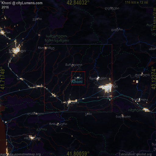
Analysis of Khoni night lights 2016
Square area 10x10 km:
 0%
0%90-99
0%80-89
0%70-79
0%60-69
0%50-59
1.21%40-49
0%30-39
1.21%20-29
0%10-19
1.21%0-9
96.36%Square area 50x50 km:
0.59%90-99
0.66%80-89
0.46%70-79
0.18%60-69
0.22%50-59
0.37%40-49
0.29%30-39
0.39%20-29
0.87%10-19
2.16%0-9
93.81%Clear (daylight) street map image can be seen on geolist.org.
Map coordinates:
42° 50' 25.2" North, 41° 43' 3" East
42° 19' 21.4" North, 42° 25' 14.2" East
41° 48' 2.1" North, 43° 7' 25.5" East
Some cities around Khoni sort by population:
• Kutaisi
23.3 km =14.5 mi,  105°
105°
• Samtredia
20.1 km =12.5 mi,  200°
200°
• Senak’i
29.6 km =18.4 mi,  258°
258°
• Tsqaltubo
14.7 km =9.1 mi,  81°
81°
• Tsalenjikha
42.6 km =26.5 mi,  317°
317°
• Abasha
20.7 km =12.9 mi,  232°
232°
• Mart’vili
10.8 km =6.7 mi,  341°
341°
• Khobi
42.9 km =26.7 mi,  268°
268°
613902 (p: 10,796)
Sources (retrieved 2019-11-25):
» Earth at Night: Flat Maps 2012, 2016