Tilbury night lights from space
Night Light of Tilbury (England) from space (United Kingdom) Src. Average luminocity for 10x10km area is 69.0909% and for 50x50km: 41.6939%.
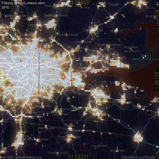
Analysis of Tilbury night lights 2016
Square area 10x10 km:
 16.44%
90-99
18.72%80-89
10.83%70-79
8.42%60-69
10.56%50-59
5.61%40-49
6.95%30-39
7.62%20-29
12.3%10-19
2.54%0-9
0%Square area 50x50 km:
9.76%90-99
9.18%80-89
4.75%70-79
4.59%60-69
4.68%50-59
4.58%40-49
4.98%30-39
6.03%20-29
10.36%10-19
16.25%0-9
24.82%Clear (daylight) street map image can be seen on geolist.org.
Map coordinates:
51° 53' 54.4" North, 0° 20' 40.4" West
51° 27' 44.9" North, 0° 21' 30.8" East
51° 1' 20.3" North, 1° 3' 42.1" East
Some cities around Tilbury sort by population:
• Grays
2.7 km =1.7 mi,  302°
302°
• Gravesend
2.4 km =1.5 mi,  159°
159°
• Swanscombe
3.8 km =2.4 mi,  242°
242°
• Chafford Hundred
5.3 km =3.3 mi, 303°
• Chadwell St Mary
2.1 km =1.3 mi,  9°
9°
• West Thurrock
5.9 km =3.7 mi,  287°
287°
• Stone
6.6 km =4.1 mi,  258°
258°
• East Tilbury
4.5 km =2.8 mi,  63°
63°
2635836 (p: 11,717)
Sources (retrieved 2019-11-25):
» Earth at Night: Flat Maps 2012, 2016