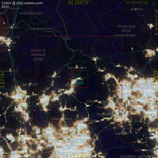
Colne night lights from space
Night Light of Colne (England) from space (United Kingdom) Src. Average luminocity for 10x10km area is 17.5384% and for 50x50km: 14.0157%.
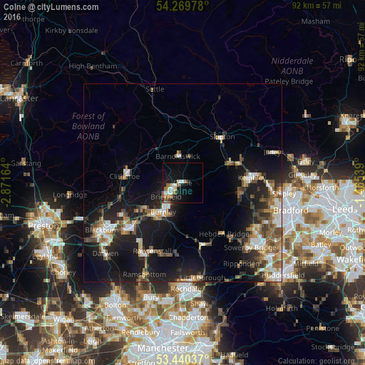
Analysis of Colne night lights 2016
Square area 10x10 km:
 2.91%
2.91%90-99
3.7%80-89
0%70-79
2.65%60-69
4.37%50-59
1.46%40-49
1.46%30-39
0.66%20-29
1.59%10-19
18.52%0-9
62.7%Square area 50x50 km:
1.8%90-99
2.17%80-89
1.12%70-79
1.51%60-69
2.11%50-59
2.43%40-49
2.08%30-39
2.14%20-29
3.82%10-19
13.1%0-9
67.73%Clear (daylight) street map image can be seen on geolist.org.
Map coordinates:
54° 16' 11.2" North, 2° 52' 17.9" West
53° 51' 25.7" North, 2° 10' 6.6" West
53° 26' 25.3" North, 1° 27' 55.4" West
Some cities around Colne sort by population:
• Burnley
7.6 km =4.7 mi,  213°
213°
• Nelson
3.4 km =2.1 mi,  217°
217°
• Cross Hills
13.2 km =8.2 mi,  65°
65°
• Padiham
11.4 km =7.1 mi,  237°
237°
• Barnoldswick
6.8 km =4.2 mi,  349°
349°
• Brierfield
5.6 km =3.5 mi,  230°
230°
• Glusburn
12 km =7.5 mi, 66°
• Barrowford
3.5 km =2.2 mi,  250°
250°
2652544 (p: 20,118)
Sources (retrieved 2019-11-25):
» Earth at Night: Flat Maps 2012, 2016