Aberdeen night lights from space
Night Light of Aberdeen (Scotland) from space (United Kingdom) Src. Average luminocity for 10x10km area is 62.1274% and for 50x50km: 6.2011%.
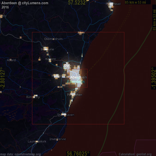

Analysis of Aberdeen night lights 2016
Square area 10x10 km:
 29.17%
90-99
17.38%80-89
2.62%70-79
2.62%60-69
3.1%50-59
3.1%40-49
4.64%30-39
5.71%20-29
7.62%10-19
10.83%0-9
13.21%Square area 50x50 km:
1.64%90-99
1.45%80-89
0.32%70-79
0.55%60-69
0.42%50-59
0.43%40-49
0.54%30-39
0.9%20-29
1.66%10-19
3.72%0-9
88.36%Clear (daylight) street map image can be seen on geolist.org.
Map coordinates:
57° 31' 23.5" North, 2° 48' 4.6" West
57° 8' 37.3" North, 2° 5' 53.3" West
56° 45' 36.9" North, 1° 23' 42.1" West
Some cities around Aberdeen sort by population:
• Inverurie
23 km =14.3 mi,  312°
312°
• Westhill
11 km =6.8 mi,  275°
275°
• Stonehaven
21.2 km =13.2 mi,  198°
198°
• Ellon
24.5 km =15.2 mi,  3°
3°
• Portlethen
8.5 km =5.3 mi,  194°
194°
• Banchory
25.7 km =16 mi,  246°
246°
• Cove
4.9 km =3 mi,  169°
169°
• Dyce
8.3 km =5.2 mi,  325°
325°
2657832 (p: 196,670)
Sources (retrieved 2019-11-25):
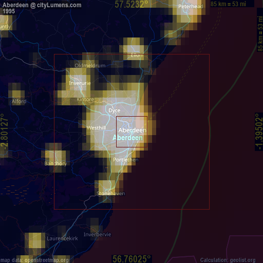
» NASA, Earths city lights 1995
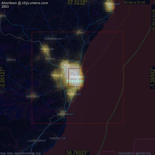
» NASA city lights 2003
» Earth at Night: Flat Maps 2012, 2016