Inverurie night lights from space
Night Light of Inverurie (Scotland) from space (United Kingdom) Src. Average luminocity for 10x10km area is 6.8648% and for 50x50km: 5.8038%.
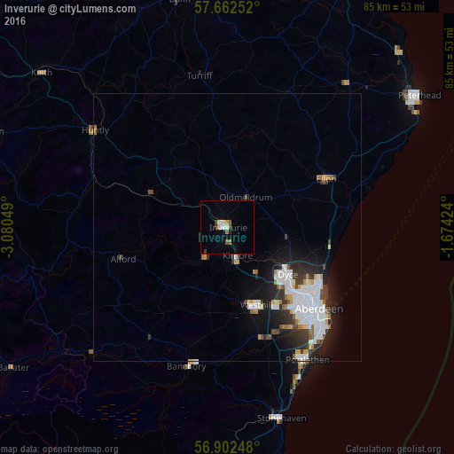
Analysis of Inverurie night lights 2016
Square area 10x10 km:
 0.34%
0.34%90-99
1.59%80-89
0.8%70-79
0.91%60-69
0.45%50-59
0.91%40-49
1.14%30-39
0.91%20-29
0.23%10-19
0.68%0-9
92.05%Square area 50x50 km:
1.58%90-99
1.35%80-89
0.3%70-79
0.51%60-69
0.38%50-59
0.44%40-49
0.54%30-39
0.89%20-29
1.63%10-19
3.33%0-9
89.07%Clear (daylight) street map image can be seen on geolist.org.
Map coordinates:
57° 39' 45.1" North, 3° 4' 49.8" West
57° 17' 4.1" North, 2° 22' 38.5" West
56° 54' 8.9" North, 1° 40' 27.3" West
Some cities around Inverurie sort by population:
• Aberdeen
23 km =14.3 mi,  132°
132°
• Westhill
15.8 km =9.8 mi,  158°
158°
• Ellon
20.3 km =12.6 mi,  64°
64°
• Portlethen
28.1 km =17.5 mi,  148°
148°
• Banchory
26.7 km =16.6 mi,  194°
194°
• Cove
27.1 km =16.8 mi,  139°
139°
• Dyce
14.9 km =9.3 mi, 126°
• Turriff
28.7 km =17.8 mi,  350°
350°
2646073 (p: 12,760)
Sources (retrieved 2019-11-25):
» Earth at Night: Flat Maps 2012, 2016