Wormhout night lights from space
Night Light of Wormhout (Hauts-de-France) from space (France) Src. Average luminocity for 10x10km area is 4.3459% and for 50x50km: 14.3957%.
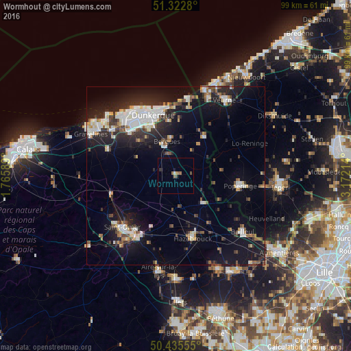
Analysis of Wormhout night lights 2016
Square area 10x10 km:
 0%
0%90-99
0.56%80-89
0%70-79
0.56%60-69
1.54%50-59
0.7%40-49
1.12%30-39
0.42%20-29
0.28%10-19
0.98%0-9
93.84%Square area 50x50 km:
2.59%90-99
2.78%80-89
1.21%70-79
1.05%60-69
1.08%50-59
1.48%40-49
1.68%30-39
1.91%20-29
4.72%10-19
12.38%0-9
69.12%Clear (daylight) street map image can be seen on geolist.org.
Map coordinates:
51° 19' 22.1" North, 1° 45' 57.2" East
50° 52' 52.6" North, 2° 28' 8.4" East
50° 26' 8" North, 3° 10' 19.7" East
Some cities around Wormhout sort by population:
• Dunkerque
18.1 km =11.2 mi,  339°
339°
• Coudekerque-Branche
16.6 km =10.3 mi, 341°
• Saint-Pol-sur-Mer
19 km =11.8 mi,  331°
331°
• Hazebrouck
18.2 km =11.3 mi,  164°
164°
• Poperinge, BE
18.3 km =11.4 mi,  99°
99°
• Cappelle-la-Grande
15.3 km =9.5 mi, 329°
• Téteghem
15.4 km =9.6 mi,  353°
353°
• Leffrinckoucke
17 km =10.6 mi,  358°
358°
2967288 (p: 5,216)
Sources (retrieved 2019-11-25):
» Earth at Night: Flat Maps 2012, 2016