Téteghem night lights from space
Night Light of Téteghem (Hauts-de-France) from space (France) Src. Average luminocity for 10x10km area is 35.8797% and for 50x50km: 12.3801%.
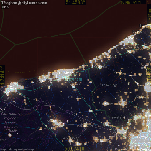
Analysis of Téteghem night lights 2016
Square area 10x10 km:
 9.22%
9.22%90-99
6.95%80-89
3.07%70-79
1.87%60-69
2.27%50-59
2.81%40-49
4.41%30-39
5.61%20-29
18.45%10-19
26.07%0-9
19.25%Square area 50x50 km:
2.46%90-99
2.69%80-89
1.05%70-79
0.96%60-69
0.85%50-59
1%40-49
1.11%30-39
1.72%20-29
4.26%10-19
10.26%0-9
73.63%Clear (daylight) street map image can be seen on geolist.org.
Map coordinates:
51° 27' 31.7" North, 1° 44' 29.1" East
51° 1' 6.9" North, 2° 26' 40.3" East
50° 34' 27" North, 3° 8' 51.6" East
Some cities around Téteghem sort by population:
• Dunkerque
5 km =3.1 mi,  288°
288°
• Coudekerque-Branche
3.6 km =2.2 mi,  277°
277°
• Saint-Pol-sur-Mer
7.5 km =4.7 mi, 280°
• Grande-Synthe
10.1 km =6.3 mi,  267°
267°
• De Panne, BE
13.7 km =8.5 mi,  49°
49°
• Cappelle-la-Grande
6.4 km =4 mi,  250°
250°
• Wormhout
15.4 km =9.6 mi,  173°
173°
• Leffrinckoucke
2.3 km =1.4 mi,  38°
38°
2973049 (p: 7,465)
Sources (retrieved 2019-11-25):
» Earth at Night: Flat Maps 2012, 2016