Wimereux night lights from space
Night Light of Wimereux (Hauts-de-France) from space (France) Src. Average luminocity for 10x10km area is 21.8557% and for 50x50km: 6.3401%.
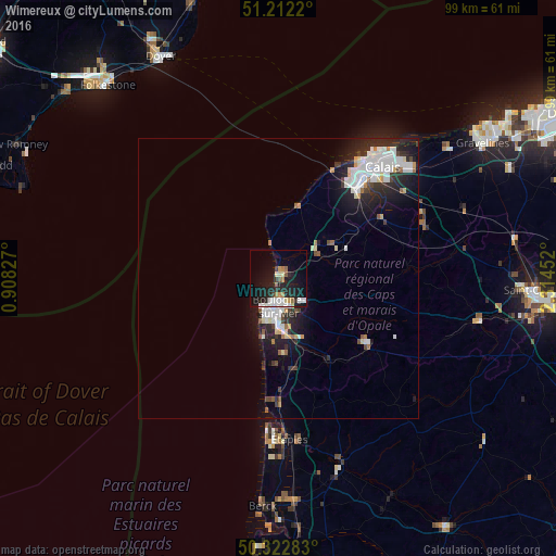
Analysis of Wimereux night lights 2016
Square area 10x10 km:
 3.36%
3.36%90-99
3.92%80-89
2.24%70-79
2.24%60-69
1.96%50-59
2.38%40-49
0.28%30-39
2.1%20-29
10.36%10-19
22.41%0-9
48.74%Square area 50x50 km:
1.54%90-99
1.5%80-89
0.49%70-79
0.38%60-69
0.42%50-59
0.39%40-49
0.49%30-39
0.69%20-29
2.38%10-19
4.44%0-9
87.27%Clear (daylight) street map image can be seen on geolist.org.
Map coordinates:
51° 12' 43.9" North, 0° 54' 29.8" East
50° 46' 10.7" North, 1° 36' 41" East
50° 19' 22.2" North, 2° 18' 52.3" East
Some cities around Wimereux sort by population:
• Boulogne-sur-Mer
4.9 km =3 mi,  177°
177°
• Outreau
7.3 km =4.5 mi,  192°
192°
• Saint-Martin-Boulogne
4.8 km =3 mi,  173°
173°
• Le Portel
7.5 km =4.7 mi,  199°
199°
• Coulogne
25.6 km =15.9 mi,  47°
47°
• Guînes
21.2 km =13.2 mi,  59°
59°
• Desvres
19.3 km =12 mi,  125°
125°
• Saint-Étienne-au-Mont
10.3 km =6.4 mi, 172°
2967351 (p: 7,663)
Sources (retrieved 2019-11-25):
» Earth at Night: Flat Maps 2012, 2016