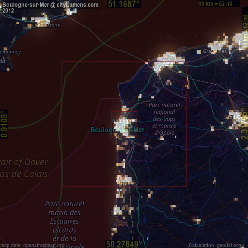
Boulogne-sur-Mer night lights from space
Night Light of Boulogne-sur-Mer (Hauts-de-France) from space (France) Src. Average luminocity for 10x10km area is 41.5455% and for 50x50km: 5.3248%.
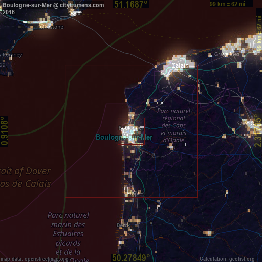
Analysis of Boulogne-sur-Mer night lights 2016
Square area 10x10 km:
 9.89%
9.89%90-99
11.9%80-89
3.74%70-79
2.81%60-69
2.14%50-59
2.67%40-49
3.34%30-39
2.94%20-29
18.85%10-19
31.55%0-9
10.16%Square area 50x50 km:
1%90-99
1.18%80-89
0.47%70-79
0.36%60-69
0.46%50-59
0.47%40-49
0.54%30-39
0.6%20-29
1.76%10-19
4%0-9
89.16%Clear (daylight) street map image can be seen on geolist.org.
Map coordinates:
51° 10' 7.3" North, 0° 54' 38.9" East
50° 43' 32.6" North, 1° 36' 50.1" East
50° 16' 42.6" North, 2° 19' 1.4" East
Some cities around Boulogne-sur-Mer sort by population:
• Outreau
2.8 km =1.7 mi,  216°
216°
• Saint-Martin-Boulogne
0.4 km =0.2 mi,  68°
68°
• Étaples
22.7 km =14.1 mi,  176°
176°
• Le Portel
3.5 km =2.2 mi,  230°
230°
• Wimereux
4.9 km =3 mi,  357°
357°
• Le Touquet-Paris-Plage
22.5 km =14 mi,  185°
185°
• Desvres
16.8 km =10.4 mi,  112°
112°
• Saint-Étienne-au-Mont
5.4 km =3.4 mi,  167°
167°
3031133 (p: 47,013)
Sources (retrieved 2019-11-25):
» Earth at Night: Flat Maps 2012, 2016