Ussel night lights from space
Night Light of Ussel (Nouvelle-Aquitaine) from space (France) Src. Average luminocity for 10x10km area is 8.1591% and for 50x50km: 1.0316%.
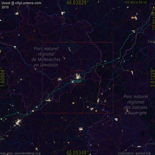
Analysis of Ussel night lights 2016
Square area 10x10 km:
 0.61%
0.61%90-99
0.76%80-89
0.45%70-79
1.21%60-69
0.76%50-59
1.67%40-49
4.55%30-39
0.91%20-29
1.21%10-19
0.61%0-9
87.27%Square area 50x50 km:
0.02%90-99
0.03%80-89
0.12%70-79
0.12%60-69
0.24%50-59
0.37%40-49
0.29%30-39
0.19%20-29
0.27%10-19
0.07%0-9
98.27%Clear (daylight) street map image can be seen on geolist.org.
Map coordinates:
46° 2' 17.8" North, 1° 36' 21.7" East
45° 32' 52.9" North, 2° 18' 33" East
45° 3' 12.5" North, 3° 0' 44.2" East
Some cities around Ussel sort by population:
• Clermont-Ferrand
65.7 km =40.8 mi,  66°
66°
• Chamalières
64 km =39.8 mi, 66°
• Tulle
52.4 km =32.6 mi,  233°
233°
• Beaumont
64.3 km =40 mi, 69°
• Aubière
66.3 km =41.2 mi, 70°
• Romagnat
64.8 km =40.3 mi, 71°
• Ceyrat
62.1 km =38.6 mi, 70°
• Égletons
25.9 km =16.1 mi, 232°
2971298 (p: 11,384)
Sources (retrieved 2019-11-25):
» Earth at Night: Flat Maps 2012, 2016