Tulle night lights from space
Night Light of Tulle (Nouvelle-Aquitaine) from space (France) Src. Average luminocity for 10x10km area is 9.2955% and for 50x50km: 2.9349%.
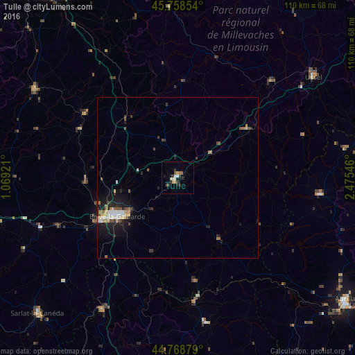
Analysis of Tulle night lights 2016
Square area 10x10 km:
 1.06%
1.06%90-99
1.21%80-89
1.52%70-79
1.06%60-69
0.61%50-59
1.21%40-49
1.21%30-39
2.73%20-29
1.52%10-19
0.61%0-9
87.27%Square area 50x50 km:
0.4%90-99
0.43%80-89
0.31%70-79
0.26%60-69
0.41%50-59
0.36%40-49
0.38%30-39
0.42%20-29
0.9%10-19
2.31%0-9
93.81%Clear (daylight) street map image can be seen on geolist.org.
Map coordinates:
45° 45' 30.7" North, 1° 4' 9.2" East
45° 15' 57" North, 1° 46' 20.4" East
44° 46' 7.6" North, 2° 28' 31.7" East
Some cities around Tulle sort by population:
• Brive-la-Gaillarde
22.2 km =13.8 mi,  237°
237°
• Aurillac
64.6 km =40.1 mi,  125°
125°
• Ussel
52.4 km =32.6 mi,  53°
53°
• Sarlat-la-Canéda
60.5 km =37.6 mi,  226°
226°
• Saint-Yrieix-la-Perche
52.3 km =32.5 mi,  301°
301°
• Malemort-sur-Corrèze
19.4 km =12.1 mi, 237°
• Terrasson-Lavilledieu
39.9 km =24.8 mi,  247°
247°
• Égletons
26.4 km =16.4 mi, 53°
2971482 (p: 16,969)
Sources (retrieved 2019-11-25):
» Earth at Night: Flat Maps 2012, 2016