Thuir night lights from space
Night Light of Thuir (Occitanie) from space (France) Src. Average luminocity for 10x10km area is 19.2727% and for 50x50km: 15.1352%.
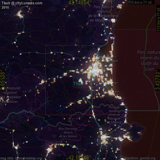
Analysis of Thuir night lights 2016
Square area 10x10 km:
 1.52%
1.52%90-99
3.18%80-89
3.18%70-79
0.45%60-69
1.67%50-59
0.61%40-49
2.88%30-39
2.42%20-29
8.48%10-19
28.48%0-9
47.12%Square area 50x50 km:
2.2%90-99
3.16%80-89
1.69%70-79
1.33%60-69
1.67%50-59
1.64%40-49
1.6%30-39
2.41%20-29
6.19%10-19
10.1%0-9
67.99%Clear (daylight) street map image can be seen on geolist.org.
Map coordinates:
43° 8' 52.9" North, 2° 3' 5.7" East
42° 37' 58.4" North, 2° 45' 17" East
42° 6' 48.5" North, 3° 27' 28.2" East
Some cities around Thuir sort by population:
• Perpignan
13.6 km =8.5 mi,  57°
57°
• Saint-Estève
11.5 km =7.1 mi,  40°
40°
• Cabestany
16.2 km =10.1 mi,  70°
70°
• Rivesaltes
18 km =11.2 mi,  32°
32°
• Ceret
16.4 km =10.2 mi,  181°
181°
• Le Soler
6.2 km =3.9 mi, 30°
• Toulouges
7.4 km =4.6 mi, 56°
• Ille-sur-Têt
11.7 km =7.3 mi,  291°
291°
2972665 (p: 7,933)
Sources (retrieved 2019-11-25):
» Earth at Night: Flat Maps 2012, 2016