Saumur night lights from space
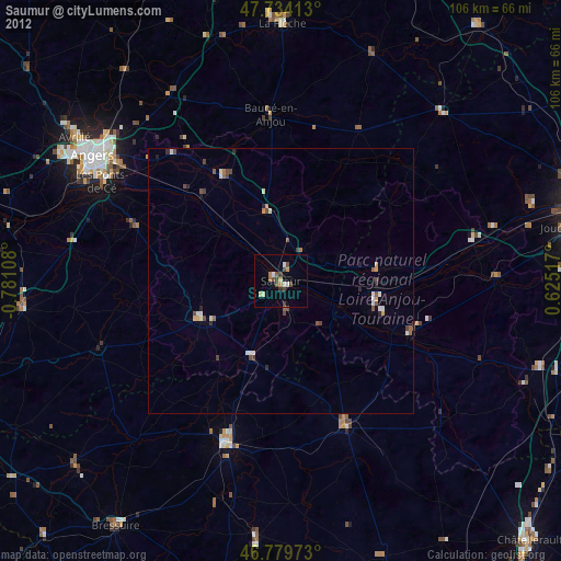
Night Light of Saumur (Pays de la Loire) from space (France) Src. Average luminocity for 10x10km area is 6.683% and for 50x50km: 1.8814%.
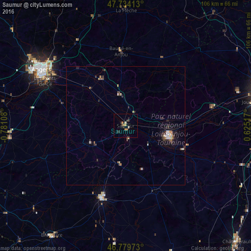
Analysis of Saumur night lights 2016
Square area 10x10 km:
 0%
0%90-99
0.74%80-89
1.04%70-79
2.08%60-69
0.3%50-59
0.6%40-49
1.19%30-39
0.3%20-29
3.27%10-19
0.89%0-9
89.58%Square area 50x50 km:
0.16%90-99
0.32%80-89
0.16%70-79
0.25%60-69
0.14%50-59
0.23%40-49
0.33%30-39
0.34%20-29
0.7%10-19
0.88%0-9
96.5%Clear (daylight) street map image can be seen on geolist.org.
Map coordinates:
47° 44' 2.9" North, 0° 46' 51.9" West
47° 15' 32.7" North, 0° 4' 40.7" West
46° 46' 47" North, 0° 37' 30.6" East
Some cities around Saumur sort by population:
• Les Ponts-de-Cé
38.3 km =23.8 mi,  298°
298°
• Trélazé
35.8 km =22.2 mi,  305°
305°
• Thouars
32.5 km =20.2 mi,  198°
198°
• Chinon
26.3 km =16.3 mi,  112°
112°
• Loudun
30.5 km =19 mi,  156°
156°
• Doué-la-Fontaine
16.6 km =10.3 mi,  243°
243°
• Jumelles
19.7 km =12.2 mi,  354°
354°
• Beaufort-en-Vallée
22.7 km =14.1 mi,  332°
332°
2975758 (p: 33,229)
Sources (retrieved 2019-11-25):
» Earth at Night: Flat Maps 2012, 2016