Sainte-Foy-lès-Lyon night lights from space
Night Light of Sainte-Foy-lès-Lyon (Auvergne-Rhône-Alpes) from space (France) Src. Average luminocity for 10x10km area is 91.3045% and for 50x50km: 34.2003%.
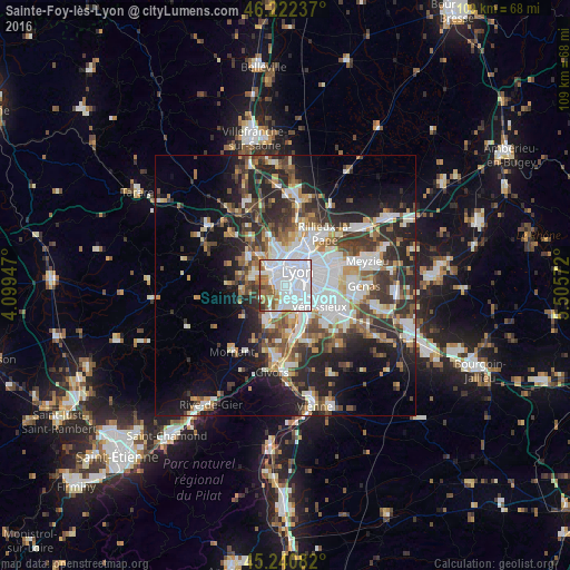
Analysis of Sainte-Foy-lès-Lyon night lights 2016
Square area 10x10 km:
 57.88%
90-99
20.15%80-89
2.42%70-79
3.64%60-69
6.97%50-59
6.36%40-49
1.36%30-39
1.21%20-29
0%10-19
0%0-9
0%Square area 50x50 km:
8.64%90-99
6.99%80-89
2.59%70-79
3.54%60-69
3.7%50-59
4.44%40-49
4.84%30-39
5.65%20-29
9.92%10-19
12.37%0-9
37.32%Clear (daylight) street map image can be seen on geolist.org.
Map coordinates:
46° 13' 20.5" North, 4° 5' 58.1" East
45° 44' 1.5" North, 4° 48' 9.3" East
45° 14' 27" North, 5° 30' 20.6" East
Some cities around Sainte-Foy-lès-Lyon sort by population:
• Lyon
3.8 km =2.4 mi,  64°
64°
• Oullins
2.2 km =1.4 mi,  170°
170°
• Écully
4.9 km =3 mi,  336°
336°
• Tassin-la-Demi-Lune
2.6 km =1.6 mi,  334°
334°
• Francheville
3 km =1.9 mi,  275°
275°
• Pierre-Bénite
3.8 km =2.4 mi,  153°
153°
• Chaponost
5.4 km =3.4 mi,  240°
240°
• La Mulatière
1 km =0.6 mi,  129°
129°
2980586 (p: 21,893)
Sources (retrieved 2019-11-25):
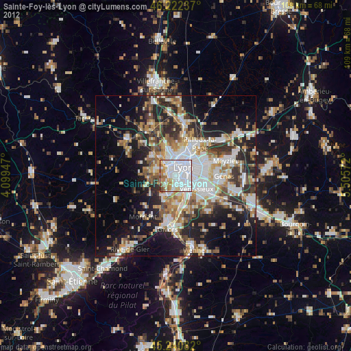
» Earth at Night: Flat Maps 2012, 2016