Saint-Martin-de-Crau night lights from space
Night Light of Saint-Martin-de-Crau (Provence-Alpes-Côte d'Azur) from space (France) Src. Average luminocity for 10x10km area is 18.7439% and for 50x50km: 16.4586%.
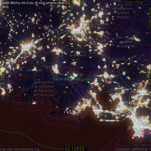
Analysis of Saint-Martin-de-Crau night lights 2016
Square area 10x10 km:
 3.94%
3.94%90-99
3.48%80-89
2.88%70-79
1.21%60-69
1.21%50-59
0.61%40-49
1.82%30-39
0.15%20-29
2.27%10-19
20.3%0-9
62.12%Square area 50x50 km:
2.14%90-99
3.33%80-89
1.93%70-79
1.65%60-69
1.51%50-59
1.43%40-49
1.56%30-39
1.24%20-29
5.43%10-19
17.55%0-9
62.23%Clear (daylight) street map image can be seen on geolist.org.
Map coordinates:
44° 8' 46.5" North, 4° 6' 34.5" East
43° 38' 22.4" North, 4° 48' 45.7" East
43° 7' 42.8" North, 5° 30' 57" East
Some cities around Saint-Martin-de-Crau sort by population:
• Arles
15.2 km =9.4 mi,  285°
285°
• Istres
19.9 km =12.4 mi,  134°
134°
• Salon-de-Provence
22.7 km =14.1 mi,  89°
89°
• Miramas
16.4 km =10.2 mi,  111°
111°
• Beaucaire
23.1 km =14.4 mi,  324°
324°
• Tarascon
22.2 km =13.8 mi,  326°
326°
• Eyguières
18.6 km =11.6 mi,  70°
70°
• Sénas
24.3 km =15.1 mi,  61°
61°
2978396 (p: 11,555)
Sources (retrieved 2019-11-25):
» Earth at Night: Flat Maps 2012, 2016